DirtMate’s success story is a testament to the power of listening to your customers. In 2019, we got an email from a customer asking a seemingly simple question: “Can we use AeroPoint technology on machines?” We heard, “machine mapping is a need.”
That idea eventually snowballed into a modular, versatile tool that construction teams around the world rely on for progress tracking and brand-agnostic equipment monitoring.
In this article, we’ll pull back the curtain and reveal how DirtMate evolved from an interesting concept to an essential tool.

2019–2020: DirtMate is born
A simple question. A big idea.
“We love AeroPoints and use them everywhere. Can we put one on a machine?”
This question sparked a realization: Propeller’s GNSS hardware, which had steadily earned a reputation for reliability and accuracy, still had untapped potential. The question “What else could we do with GNSS receivers?” soon joined forces with another concept: GIS.
In its simplest terms, GIS can be boiled down to the concept of “dots on maps.” It’s generating geospatial data to represent discrete objects like machines or other points of interest. Machine mapping in its most simple form.
Out of this intersection between GNSS hardware and evolving ways to use worksite maps, DirtMate was born.
The original DirtMate was a bit rough around the edges:
- Hardware: Essentially an AeroPoint encased in foam
- Software: Introduced surface mapping and “snail trails” to track machine locations and routes
While the earliest DirtMate could map surfaces, we didn’t yet have a way to integrate non-drone geospatial data into the platform. The vision of “dots on a map” was clear. The path to get there wasn’t.
2021–2022: DirtMate 1.0
One size fits most.
Over the next few years, DirtMate evolved from basic machine tracking into a comprehensive production data hub. Where tracking data from equipment manufacturers is siloed in proprietary systems, we unified machine tracking data in one place to provide a holistic view of worksite operations.
What made DirtMate different:
- Drone integration: DirtMate filled in the gaps between drone surveys, enabling continuous progress tracking
- Surface true-up: Customers could use drones to reset their site’s baseline topo, then supplement that data with DirtMate for daily updates
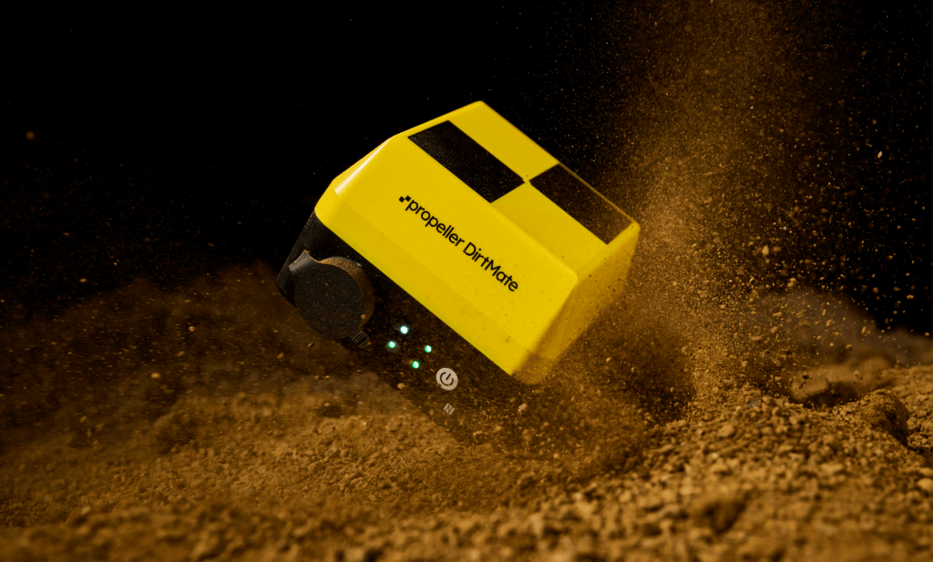
- Hardware: DirtMate’s hardware got an upgrade with durable plastic enclosures, waterproof solar panels, and an increasingly rugged design to ensure reliable performance in harsh conditions
- Software: A field-focused interface, the DirtMate Dashboard, gave users quick access to runtime data, surface changes, and machine trails
Now that equipment data and drone data lived within the same software ecosystem, machine trails and runtime weren’t enough. Customers wanted real-time production data. Think cycle counts, load counts, and daily volume shifts.
2023–2024: DirtMate 1.5
Evolution by request.
In direct response to user feedback, we started working on a modular system designed to tailor DirtMate to diverse use cases.
Hardware:
- Sensor brain: We made DirtMate’s central sensor separate from its removable batteries and other elements
- Climate adaptability: DirtMate can withstand a wide range of temperature, moisture, and light conditions, meeting the needs of our customers around the globe
- Custom mounting options: DirtMate isn’t just for machines, making it versatile enough to be mounted anywhere, including buoyant platforms for measuring water levels
Software:
- Together at last: Field teams wanted to view DirtMate data within the main Propeller platform, without having to visit a separate dashboard
2025: DirtMate 2.0
Many sizes fit all.
Today, DirtMate has matured into a fully modular and intuitive tool that adapts to a wide range of use cases.
- Position tracking: Monitor the real-time location of any machine, object, or structure across your site
- Machine telematics: Get real-time production dashboards with run time, load counts, cycle data, and machine trails, all on one map
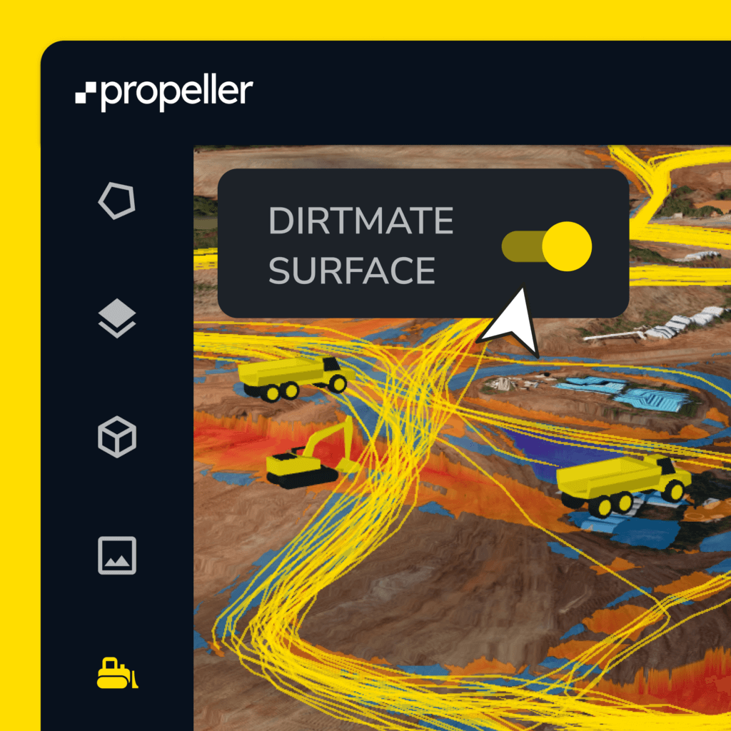
- Progress tracking: Get daily production volumes, plus real-time surfaces and cut-fill heatmaps
Hardware:
- Better climate resilience and power solutions for consistent performance
- Expanded mounts, cables, and other options so you can use DirtMate anywhere on site
Software:
- DirtMate’s data is now fully integrated within Propeller’s cloud-based platform and mobile app
DirtMate key features:
- High-precision GNSS receiver (absolute ±0.03ft)
- Built-in wifi and cellular
- 7,600mAH battery
- Auto on/off
- 1,000-plus hours data storage
- Onboard IMU
DirtMate RTK
The platform comes to the ground.
DirtMate RTK is the next step in Propeller’s evolution as the real-time command center for earthwork. The platform has always connected the office and the site. DirtMate RTK brings that connection to the ground and into the hands of the person running the show.
It’s a subscription upgrade that unlocks high-precision site supervision tools for foremen and operators. One device that works in the cab, on a rod, and across the whole fleet. All of this without a specialist, without expensive equipment, and without leaving the Propeller ecosystem.
What DirtMate RTK unlocks:
- Compare surfaces to design on the spot: No delay because foremen can compare surfaces to design and verify progress in real time
- Stakeout and point capture: Capture data that syncs directly back to the Propeller platform, creating a timestamped record of site activity
- Fleet elevation monitoring: See every machine’s live elevation on one map, in real time
- In-cab situational awareness: Operators get a live view of their position against design surfaces, linework, and site boundaries
15-minute setup. Minimal learning curve. Everything synced back to the map your whole team already works from.
Built with your worksite in mind
Your feedback wrote this story.
At every stage, DirtMate’s story has been written by direct customer input and real-world use cases where machine mapping was crucial to project success. By working together with our users, we’ve designed DirtMate to be the ideal solution to their progress-tracking challenges.
As we look ahead to DirtMate’s next chapter, we’ll keep looking for ways to deliver actionable site insights that help teams work smarter, safer, and with more confidence.
Ready to learn more about DirtMate? Request a demo today.