Plan for Gulf Coast storms before water disrupts the jobsite
Use current site data to simulate rainfall, model runoff, identify drainage paths, and visualize flood exposure — so your team can plan around water risk before the next major storm.
Propeller helps Gulf Coast construction teams plan around drainage risk in 3D, using hydrology workflows built for practical jobsite decisions.
Plan around drainage risk as site conditions change
Use current site data to verify drainage performance and spot pooling, erosion, and unexpected flow paths before they affect access or active work. Identify low-lying areas early, adjust staging, stockpiles, excavations, and temporary drainage controls, and give field and office teams clearer visual context for BMP, SWPPP, and stormwater planning.
See where water will go before it affects the jobsite
Use Propeller’s four hydrology workflows to plan around year-round rainfall, hurricane-season storms, saturated conditions, and changing site terrain.
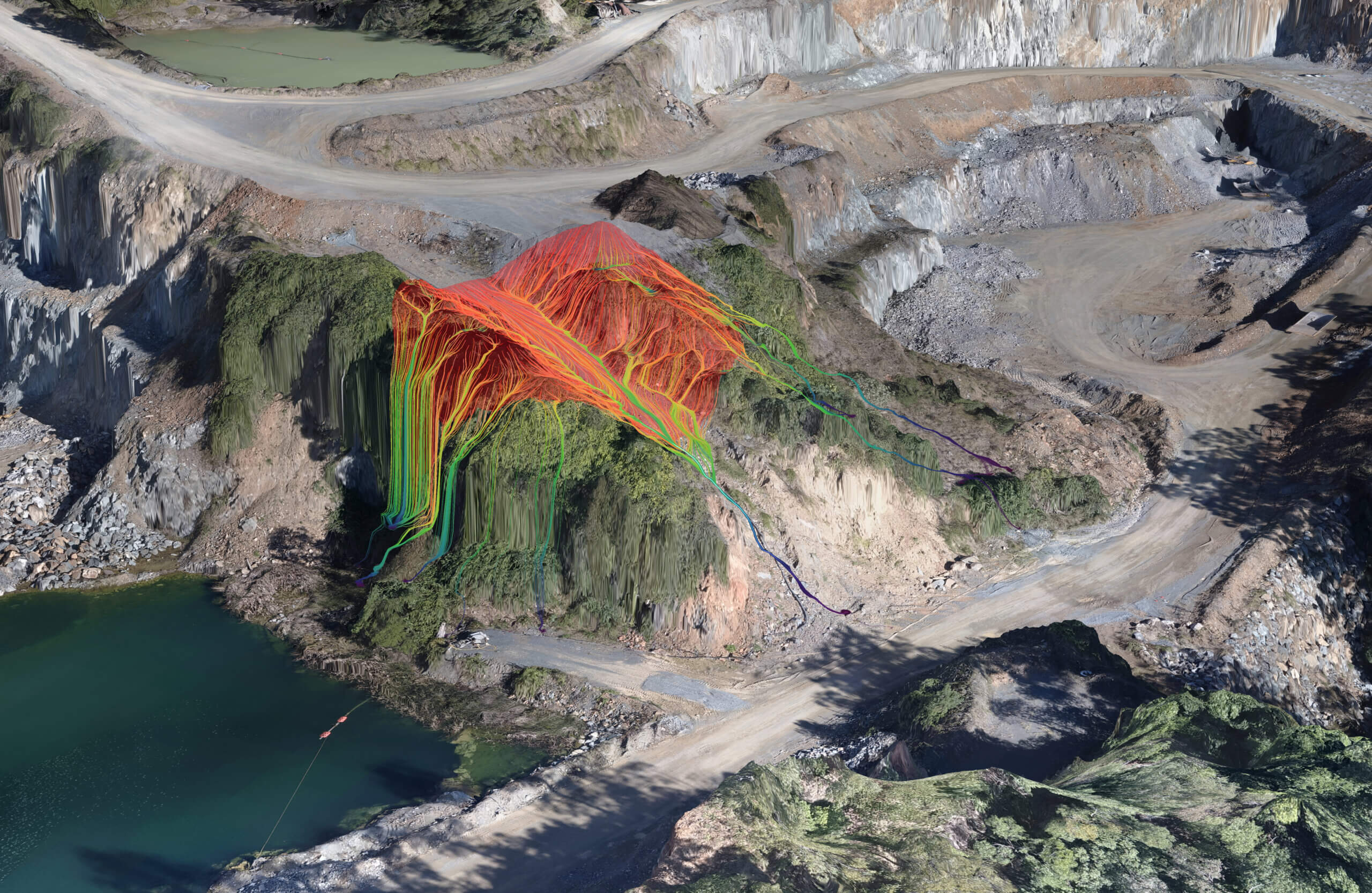
Model where stormwater may flow before it threatens site access
Use current terrain data to see how runoff may move across roads, pads, slopes, and active work areas before it threatens access or causes erosion. This visibility can also support BMP placement, SWPPP reviews, and clearer stormwater conversations between field and office teams.
Use this to plan:
- Haul roads and site access
- Equipment and stockpile placement
- Temporary drainage and erosion controls
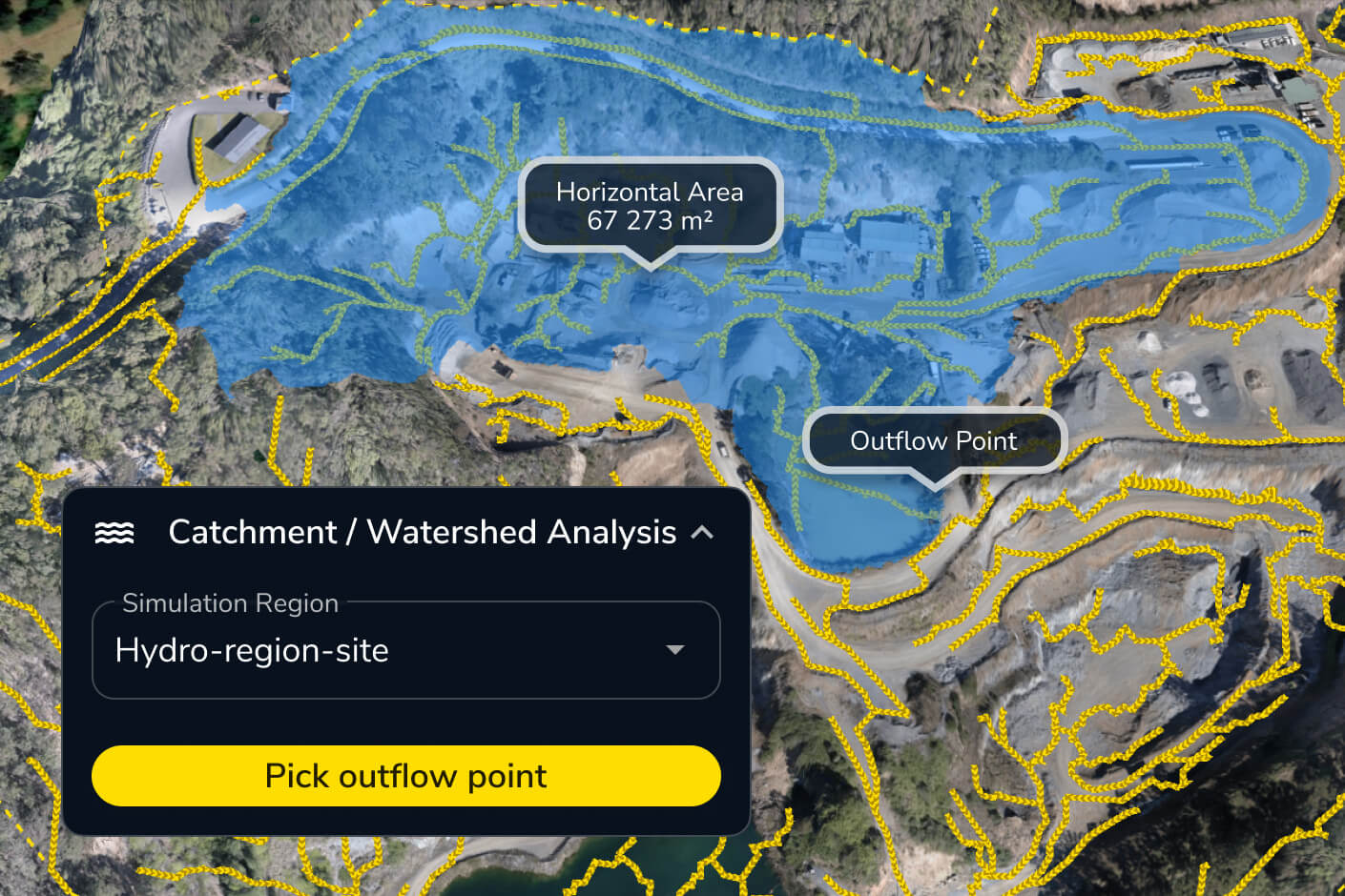
Analyze runoff feeding basins, ditches, and low-lying areas
Identify the catchment feeding a basin, ditch, culvert, outfall, or low point so teams can focus drainage reviews where they matter most.
Use this to plan:
- Basins, ditches, and swales
- Culverts and outfalls
- Upstream runoff and diversion paths
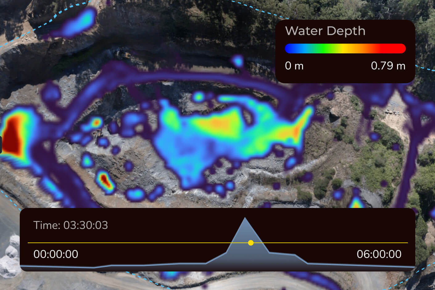
Simulate heavy rainfall against current site conditions
Apply a rainfall scenario to the latest surface to visualize where water may flow, pool, or spill into critical areas.
Use this to plan:
- Heavy-rain scenarios
- Ponding and spillover zones
- Pre-storm mitigation reviews

Visualize flood exposure across low-lying work areas
Set a water elevation to visualize which low-lying parts of the current site could be affected.
Use this to plan:
- Access and staging areas
- Excavations, pads, and work zones
- Selected water-level scenarios
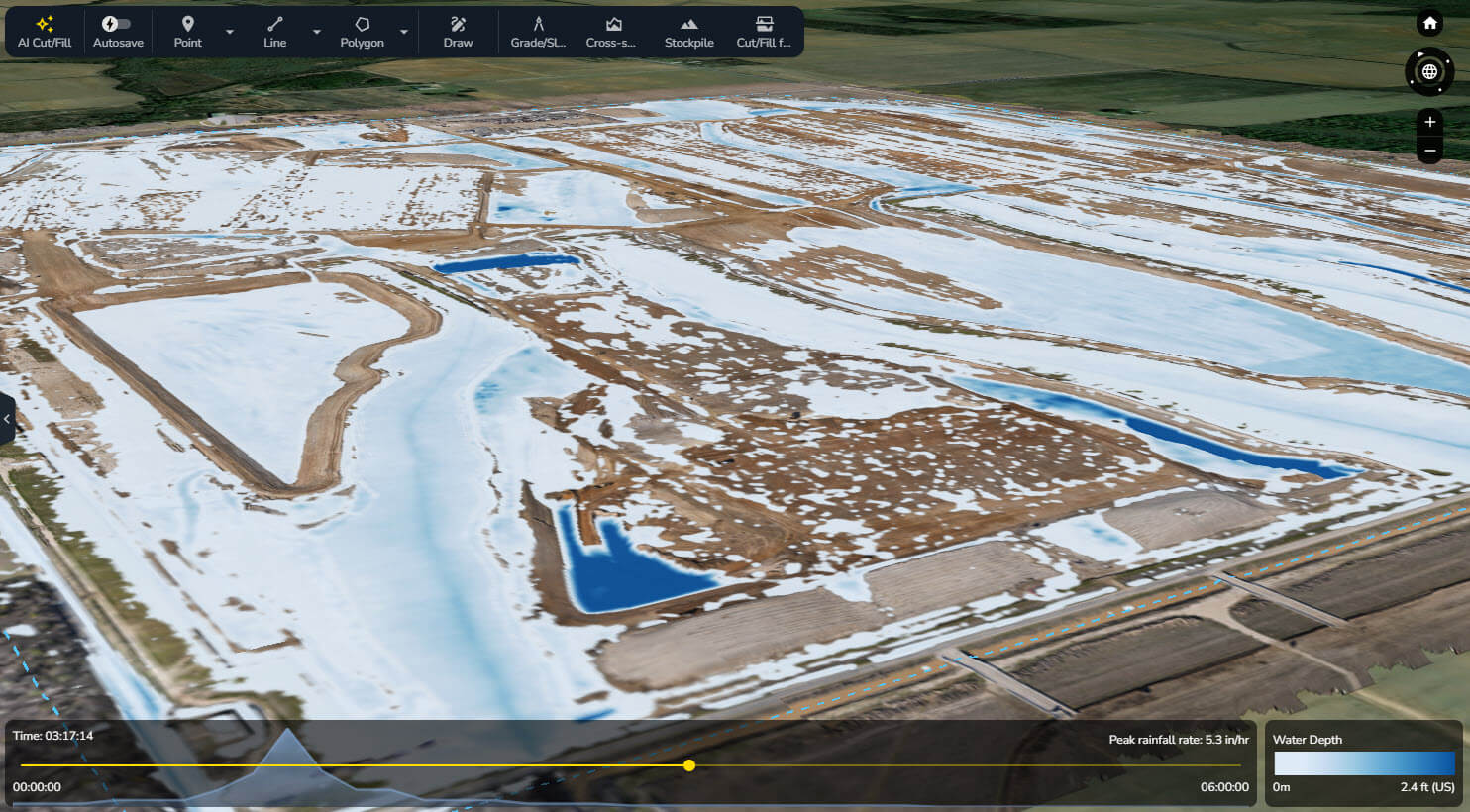

On one massive data center project, where it rains “feet at a time,” Mortenson used Propeller to simulate rainfall events against current conditions, validate basin and swale capacity, and visualize water-shedding paths — supporting both environmental planning and daily earthmoving decisions.
“You show that to an environmental specialist, and they can’t pick their jaw up off the ground.”
– Mickey Kocemba, Senior Lean Innovation Manager at Mortenson
Integrate hydrology data with your existing construction workflows
Seamlessly integrate Propeller data, including digital elevation models, with your favorite tools. Automate reporting, streamline operations, and maximize efficiency.
Frequently asked questions
Propeller’s Direct Rainfall Simulator uses the current site surface to show how water may flow and pool under a selected rainfall scenario. Teams can use the results to identify risks around haul roads, pads, stockpiles, equipment staging areas, excavations, drainage controls, and site access before a major storm affects the work.
Propeller helps teams review how rainfall-driven runoff, pooling, drainage paths, catchments, and selected water levels relate to current site terrain. It supports pre-storm planning and post-storm site review, but it does not forecast hurricanes, model storm surge, provide emergency alerts, or replace official weather and emergency-management guidance.
Yes. Propeller helps teams visualize current drainage paths, runoff sources, ponding areas, and erosion risks to support BMP placement, site reviews, and SWPPP conversations. Propeller does not create, inspect, or certify a SWPPP, and operators remain responsible for applicable federal, state, and local permit requirements.
Propeller lets teams simulate rainfall against the current site surface, identify the areas feeding runoff into a selected point, and visualize how water moves across surrounding terrain. These insights can support capacity reviews and mitigation planning as site conditions change. Engineering calculations and final design validation should remain with the appropriate qualified professional.
Surface Runoff shows the likely path water may take as it moves across the current surface. Flood to Level shows which areas may be affected if water reaches a specified elevation. Gulf Coast teams can use both to review roads, access points, retention areas, excavations, pads, staging zones, and low-lying work areas.
No. Propeller’s hydrology tools help teams understand rainfall, runoff, drainage, catchments, and selected water-level exposure using current site data. They do not predict storm surge or replace FEMA flood maps, official floodplain studies, permitting requirements, engineered hydrology analysis, or emergency guidance.
Yes. Storms create urgency, but drainage conditions change throughout the project. Teams can use Propeller after grading changes, new stockpile placement, road construction, or basin work to check how the current surface may affect runoff, ponding, and site access year-round.