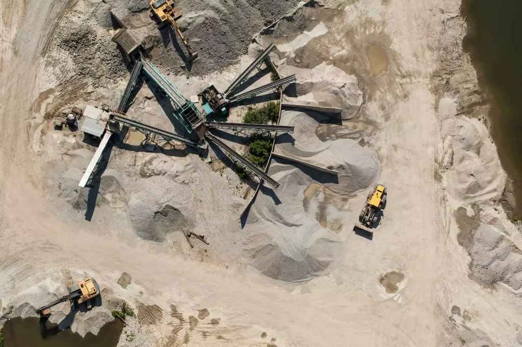
In the past, the civil construction and earthworks industries were slow to adopt technology solutions. But recently, technology like drone surveying has become popular in the industry with its ability to assess worksites from above by capturing images to generate site surveys (also referred to as “topo’s”). Furthermore, the technology has advanced considerably over the past few years such that investing in a drone survey program is no longer risky–it’s a sound business decision, especially with the construction industry’s positive 2023 outlook and rapid adoption of innovative technologies to drive efficiency.
A drone (also known as an unmanned aerial vehicle or UAV) purchase is not just an expense. It’s an investment. In today’s economic climate, civil construction and earthworks companies are asked to be more efficient, doing more with less. And in an environment where skilled labor is limited, companies want to ensure they have enough manpower to support all their projects. Surveying with a drone is more efficient and less time consuming, which can free up labor resources for other important work.
Here, we’ll take a look at three reasons why now is the right time to invest in aerial drone surveying for your worksite.
Accuracy
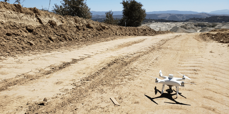
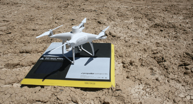
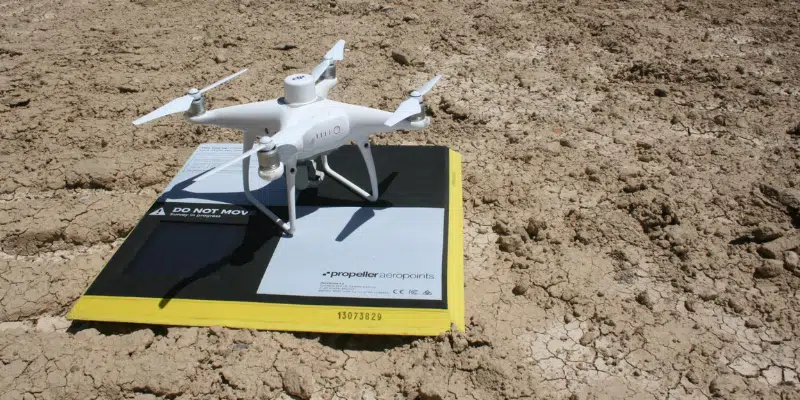
UAV survey accuracy is a primary focus that earthworks and civil construction companies considering a drone survey program have. Using the Propeller PPK workflow, the combination of an RTK-enabled drone and AeroPoints makes it possible to achieve 1/10ft (3cm) accuracy consistently with each survey…and significantly faster than you could using traditional survey methods with a base and rover.
Commercial grade drones, like DJI’s Mavic 3 Enterprise (M3E), contain an on-board real-time kinetic sensor, which geotags every photo of the worksite as it’s captured. That way, as drone survey data is corrected against ground control through a platform like Propeller, each image effectively serves as its own additional control point, resulting in an accurate site map. You can also fly your worksite as often as you need to, to conduct meaningful progress tracking.
Better cost control
In talking to earthworks professionals, the cost of adoption and lack of a proven ROI are common reasons given by those companies who haven’t yet invested in a drone program.
However, these are misconceptions. High quality, affordable drone technology is widely available today, and an initial UAV investment shouldn’t break your budget. With just a single drone and one of Propeller’s AeroPoints, you can get accurate data about your job site rather quickly. For example, a 50-acre site typically takes about 30 minutes to survey with a drone. This empowers you to survey more sites more frequently, and use that data for smarter progress tracking and strategic planning.
In fact, one Propeller customer’s entire aerial drone survey program paid for itself in a single flight. According to Grade Tech’s Rory Hall, between the amount of time being able to survey with drones has put back into his day, the ability to catch mistakes earlier on, and the faster decision making drone data enables, he saves $3,500 every time he flies.
Statistics around construction project costs show that most projects run over budget and behind schedule. But Propeller customers consistently demonstrate why drone technology is an invaluable asset for keeping projects on track, improving communication, and optimizing labor.
Reliability
Just about five years ago, drones were mistakenly thought of more as toys for hobbyists without much practical application. However, RTK-enabled drones like the M3E, and also DJI’s Phantom 4 RTK, have changed that thinking.
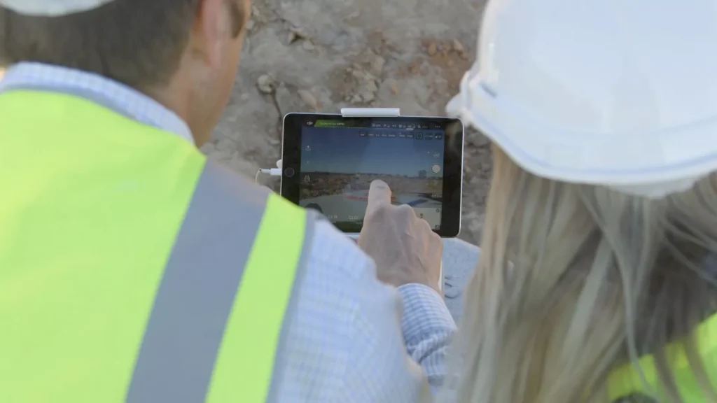
Speed and accuracy have combined for a streamlined flight experience. With your own drone survey program, there’s no need to call a surveyor to your site every time you want quantities measured or progress tracked.
You don’t even need a highly-trained drone pilot. Drones are now so reliable and user-friendly that anyone can earn their Part 107 license with ease. Users can direct their drone using an interactive flight controller to upload a flight path in advance, and then simply monitor the drone’s progress during the flight.
The aerial-optimized, wide-angle camera lens ensures clear photos every time you fly. In summary, commercial-grade drones like the Phantom 4 RTK and the M3E work reliably with no expert-level assistance required.
Propeller customer Nicole Sheckler from Sheckler Excavation has advice for earthworks and construction companies considering a drone surveying solution. Not only is Propeller easy for her to use, but data processing turnaround time has been ideal
“It takes us only about 2-3 hours to fly a large, 100-acre landfill site. After we upload all of our data to Propeller, it takes about 24 hours for us to get everything back, which is really helpful. To anyone considering drone surveying, I’d tell them to just do it! You’re considering it for a reason, and it will really help your business.”
Today, the need for digital transformation in the construction industry has become much stronger. More and more civil construction companies are using a UAV survey workflow to win bids, tighten the bottom line, improve communication among stakeholders, and keep projects running smoothly.
The real question isn’t whether drones would be an asset to your worksite, but rather, can you afford NOT to have a drone survey program?