Best mapping software compatible with DJI drones

Read Time: 8 mins
Quick links
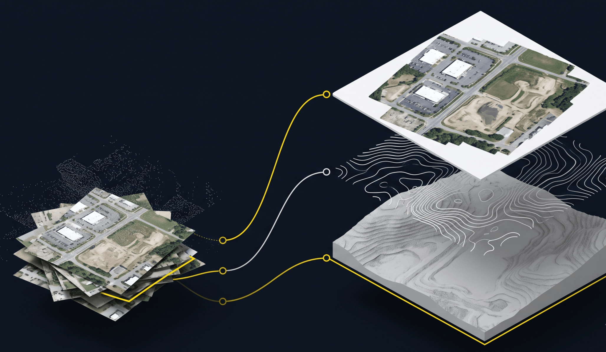
    Isometric illustration of raw drone photos and a point cloud assembling into a single layered site map with orthomosaic, contour, and 3D terrain layers

    DJI-compatible mapping software processes drone imagery into orthomosaics, terrain models, and measurement reports, giving construction, survey, and mining teams the volumes, design comparisons, and progress records they bill and plan from. This guide compares Propeller, Pix4D, DroneDeploy, DJI Terra, and ArcGIS Drone2Map, and explains how to pick based on the decisions your team needs the data to support.

    DJI-compatible mapping software processes drone imagery into orthomosaics, terrain models, and measurement reports used for construction, surveying, mining, and infrastructure projects. This guide compares the most widely used platforms, including Propeller, Pix4D, DroneDeploy, DJI Terra, and ArcGIS Drone2Map, and explains how to choose based on your project requirements.

    DJI is the most widely used drone manufacturer in commercial operations. Its hardware, including the Phantom, Matrice, and Mavic lines, has become a standard tool across construction, surveying, mining, infrastructure, and agricultural projects worldwide.

    But choosing the right mapping software is often more consequential than choosing the drone. The platform determines what you can do with the data: the quality of your maps, the accuracy of your measurements, the speed of your reporting, and how well your drone photogrammetry workflows connect to the rest of the project.

    This guide compares the best mapping software options for DJI drones and explains what to look for based on your industry and project requirements.

    What does mapping software for DJI drones do?

    Mapping software converts drone imagery into usable outputs: orthomosaics, terrain models, point clouds, and measurement reports.

    When a DJI drone captures imagery over a site, the raw photos contain embedded GPS position data and enough visual overlap to reconstruct the three-dimensional geometry of the scene. Mapping software takes those raw inputs and processes them into outputs that teams can measure from, overlay designs onto, and share with stakeholders.

    Core capabilities most platforms deliver:

    Data processing: Converting raw imagery into orthomosaics, digital terrain models (DTMs), digital surface models (DSMs), and point clouds
    Site visualization: Viewing the processed site in 2D and 3D, from any device, without specialist hardware
    Survey outputs: Delivering the specific drone survey outputs a team needs: orthophotos, cross-sections, contour lines, and elevation reports
    Measurements and reporting: Calculating distances, areas, and volumes, and generating exportable reports
    Collaboration tools: Giving the whole project team access to current site data without requiring each person to process files locally

    What separates platforms is depth: how accurately each output is generated, how quickly data is available, and how well the platform supports the specific workflows of a particular industry.

    Key features to look for in DJI drone mapping software

    The best DJI mapping software combines accurate data processing, reporting tools, cloud collaboration, and construction-specific workflows.

    Orthomosaic and mapping capabilities

    The quality of the orthomosaic is the foundation of everything else. Look for platforms that support PPK drone mapping and RTK GPS correction workflows, handle ground control points reliably, and produce consistent outputs across varied terrain. Strong photogrammetric correction workflows reduce field time while maintaining accuracy.

    Survey outputs and measurements

    Beyond orthomosaics, strong platforms deliver terrain models, point clouds, cross-sections, and elevation data. The ability to generate these outputs automatically, rather than requiring specialist post-processing, is what makes drone mapping practical for teams operating at pace.

    Cloud collaboration

    Teams that rely on data stored on a single computer or processed locally create bottlenecks. Cloud-based platforms make current site data available to everyone (office, field, and remote stakeholders) as soon as processing is complete.

    Volume calculations and earthworks analysis

    For construction, earthworks, and mining teams, volume calculations are one of the most valuable deliverables from drone data. Look for platforms that support cut/fill analysis, stockpile measurement, and design surface comparisons, not just raw terrain models.

    Reporting and project tracking

    The platform should produce outputs that slot directly into project workflows: pay application summaries, progress reports, design conformance checks, and audit-ready volume records. Propeller’s daily reporting tools are built for exactly this kind of operational workflow, connecting site data to the documents project teams actually need.

    Best mapping software compatible with DJI drones

    Different drone mapping platforms are designed for different industries, workflows, and project requirements. Here is how the main options compare.

    Platform Best for Key strengths Limitations
    Propeller Construction, earthworks, mining Volume calculations, design overlays, AeroPoints ground control, DirtMate integration, cloud processing Purpose-built for industrial workflows, not designed for consumer or GIS-research use cases
    Pix4D Surveyors, geospatial professionals Advanced processing controls, detailed QA reports, PPK/RTK support, industry modules Steeper learning curve, complex licensing, less construction-focused collaboration
    DroneDeploy Broad commercial use Cloud-first, accessible reporting, project management integrations Volume accuracy and survey-grade outputs may not match specialist platforms for complex earthworks
    DJI Terra Local processing, DJI ecosystem teams Native DJI hardware integration, offline processing, mission planning No cloud collaboration, no construction management tools: a processing step, not a platform
    ArcGIS Drone2Map GIS professionals in the Esri ecosystem Deep ArcGIS integration, spatial analysis, broad output format support GIS-first tool, limited construction measurement, reporting, and progress tracking workflows

    Propeller

    Propeller is designed specifically for the operational needs of earthwork and construction teams. The platform processes DJI imagery alongside other supported sensors into orthomosaics, terrain models, and volume data, then delivers those outputs through a cloud-based viewer accessible on any device.

    Key strengths:

    Volume calculations for cut/fill, stockpiles, and design conformance
    – Design overlay tools for comparing site conditions against CAD and design surfaces
    AeroPoints ground control for high-precision surveys without complex field setup
    DirtMate integration that layers machine telematics onto the same map as drone survey data
    – Cloud processing with outputs typically available in under 24 hours
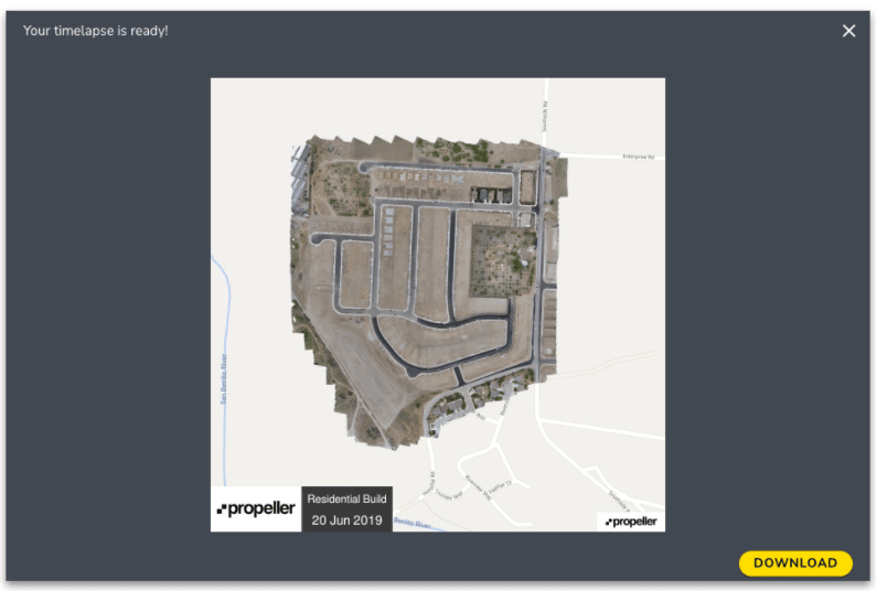
    Progress tracking tools that build a timeline of site changes over the project lifecycle

    As Benedikt Schauerte, Surveyor and Site Manager at Franz Trippe GmbH, said after adopting the platform: “It motivates us to do more! With the drone, we are advancing our commitment to digital innovation.”

    Franz Trippe surveyed a 26-hectare quarry with complex terrain in 1.5 hours, versus multiple days with traditional methods. Read the full story.

    Limitations: Propeller is built for construction and industrial workflows. It is not designed for photogrammetric research, complex GIS analysis, or consumer mapping use cases.

    Pix4D

    Pix4D is one of the most established names in drone photogrammetry software. The platform offers deep control over processing parameters, advanced accuracy reporting, and integration with professional surveying equipment and CAD systems.

    Key strengths: Advanced processing options with detailed quality reports, strong PPK and RTK support, industry-specific modules for agriculture, BIM, and inspection, and desktop plus cloud processing flexibility.

    Limitations: The platform’s depth can create a steeper learning curve. Licensing can be complex, and the feature set may exceed what construction teams need for day-to-day site monitoring. Cloud collaboration tools are less construction-focused than platforms built specifically for that workflow.

    DroneDeploy

    DroneDeploy is widely used across construction, agriculture, and infrastructure. The platform prioritizes ease of use and cloud delivery, with automated processing and reporting features accessible to teams without dedicated survey staff.

    Key strengths: Cloud-based processing and delivery, accessible flight planning and mission management, integrations with project management tools, and report generation with annotation features.

    Limitations: Volume accuracy and survey-grade outputs may not match platforms with deeper geospatial controls. Teams with complex earthworks measurement requirements may find the construction-specific tools limited compared to specialist options.

    DJI Terra

    DJI Terra is DJI’s own mapping and mission planning software. It supports DJI hardware natively and allows teams to process imagery locally without an internet connection.

    Key strengths: Native DJI hardware integration, local processing without a cloud requirement, mission planning and automated flight control, and basic point cloud and 2D map outputs.

    Limitations: DJI Terra is a processing and mission planning tool, not a construction management platform. It does not offer cloud collaboration, design overlay, or ongoing site monitoring. Teams typically use it as a processing step before working with outputs in another platform.

    ArcGIS Drone2Map

    ArcGIS Drone2Map processes drone imagery into GIS-compatible outputs and connects directly with ArcGIS platforms. It is most valuable for teams whose primary tool is ArcGIS and who need drone data to feed into existing spatial analysis workflows.

    Key strengths: Deep ArcGIS integration, familiar interface for Esri users, strong spatial analysis and mapping capabilities, and broad output format support.

    Limitations: Drone2Map is a GIS-first tool. It does not provide the construction-specific measurement, reporting, and progress tracking workflows that earthworks and civil teams need. Cost and licensing are tied to the Esri ecosystem.
    Free vs enterprise drone mapping software

    Free mapping software can support basic workflows, while enterprise platforms provide scalability, automation, collaboration, and support.

    Several platforms offer free or low-cost tiers, including WebODM, OpenDroneMap, and DJI Terra’s basic license. For teams getting started with drone mapping or running low-volume operations, these can be a practical starting point.

    The limitations become clear as requirements grow:

    Processing volume: Free tiers often cap the number of images or area size that can be processed in a single run
    Team collaboration: Sharing processed data with the full project team typically requires a cloud platform
    Reporting: Automated, standardized reports are a paid feature on most platforms
    Security: Enterprise environments need role-based access controls and data governance that free tiers rarely provide
    Scalability: A workflow that works for one site and one operator often breaks down when scaled to dozens of sites and a large team

    For construction teams running active project programs (multiple sites, regular survey cycles, and multiple team members who need access to current data), enterprise platforms with cloud processing and survey processing capabilities deliver value that free tools cannot match.

    Best DJI mapping software for construction projects

    Construction projects require mapping software that supports construction site planning, progress tracking, earthworks measurements, reporting, and operational decision-making.

    The right platform is one that does more than process imagery. It needs to support the measurement workflows that define a construction project:

    Earthworks: Volume calculations tied to design surfaces, not just terrain models in isolation
    Progress tracking: A timeline of site captures showing change over time, measurable, not just visual
    Site planning: The ability to overlay design files and verify that field conditions match the model
    Reporting: Outputs that slot directly into the workflows your project team, clients, and subcontractors already use
    Survey frequency: Support for the capture cadence your site demands: weekly, daily, or anything in between

    Platforms built specifically for construction workflows consistently deliver better operational outcomes than general-purpose mapping tools adapted for construction. The survey processing pipeline, accuracy methodology, and reporting features are designed around the decisions construction teams actually need to make.

    Choose software for the outcome, not just the output

    Choosing mapping software for DJI drones is not just a question of processing capability. It is a question of what your team can do with the data once it is processed.

    The platforms that deliver the most value in construction, earthworks, mining, and infrastructure workflows are the ones that close the gap between raw imagery and operational decisions: measurement workflows that support billing, progress records that support dispute prevention, and reporting tools that give every stakeholder a clear view of where the project stands.

    Evaluate software based on operational outcomes, not just processing specifications.

    Request a demo to see DJI drone mapping workflows in action with Propeller

    Frequently asked questions

    The best platform depends on your use case. For construction, earthworks, and industrial workflows, Propeller provides the most complete set of tools for measurement, progress tracking, and project reporting. For advanced photogrammetric control, Pix4D is a strong option. For GIS integration, ArcGIS Drone2Map suits teams embedded in the Esri ecosystem.

    DJI Terra offers a basic free version for 2D map creation. Advanced features, including 3D reconstruction and multi-spectral processing, require a paid license.

    Yes. DJI drones, particularly the Matrice series, are widely used in construction surveying workflows. The key variable is the mapping software and ground control methodology used to process the imagery.

    Accuracy depends more on survey methodology (PPK/RTK corrections, ground control points, flight planning) than on the software platform alone. That said, platforms built for high-precision surveying workflows consistently produce better accuracy than general-purpose tools.

    Processing time varies by platform and image count. Cloud processing platforms like Propeller typically return outputs in under 24 hours for standard site surveys.

    Ground control points improve absolute accuracy. AeroPoints simplify this process significantly, providing accurate ground control without the need for traditional base-and-rover setup. PPK workflows can achieve similar results with different field procedures.

    Quick links

      Related articles

      Better blast planning, monitoring and quarry reporting using drone data

      Propeller gives mining teams accurate pre- and postblast site data by combining high-precision drone surveys…

      Six smart ways to use drones in mines and quarries

      The use of drones in mines and quarries is common, but these sites are highly…

      Cross section survey in a matter of minutes using drone data

      With the power of drone-captured data and the Propeller Platform, surveying cross sections becomes as…

      Ready to learn how Propeller can power up your worksite?

      We’re happy to show you how Propeller can power your worksite, and boost productivity.

      Related articles

      Drone pilot in hi-vis flying a drone next to a crane, with an AeroPoint on the floor.

      Things To Know About Ground Control in Drone Surveying

      Ground control is the go-to option for turning drone data into highly accurate, survey-grade models.…
      DJI M4E flying in the sky

      Propeller’s Drone Guide: DJI Solutions for Commercial Operations

      At Propeller we love testing new drone hardware and we are processing hundreds of drone…

      Telecom Tower Inspection using DJI Phantom 4 Pro: Step-by-Step Guide

      A few weeks ago a new DJI Phantom 4 Pro was delivered to our office.…