Real sites, real results: How earthwork teams are winning with Propeller

Read Time: 6 mins
Quick links

    Real sites, real results: How earthwork teams are winning with Propeller

    You can tell when an earthwork crew is firing on all cylinders.

    The crew isn’t standing around waiting for data; it’s in their hands, driving decisions in real time. The supervisor catches a grade issue on Tuesday instead of finding out during the monthly walkthrough, preventing weeks of rework. The PM walks into a client meeting with a virtual site map showing proof of progress that’s easy to share, instead of a verbal “trust me” and a month-old printout.

    This is not a hypothetical. Across the Propeller community, teams are working this way right now, in real conditions, on every continent we work across.

    So in this post, we’re shining a spotlight on our community. Read on for real stories from teams who’ve figured out how to speed up their workflow without sacrificing quality, plus the three patterns we’ve spotted in winning teams.

    Saving time with faster data, fewer manual steps, and quicker decisions

    Jon Lange runs a surveying business in Colorado. Before Propeller, his team surveyed residential development sites the conventional way: boots on the ground for days at a time, walking grids, capturing data points between markers, and hoping nothing got missed. All too often, this process resulted in unbudgeted earthwork costs, discovered only after work was underway.

    When Lange Land Surveys took on the Candelas development for Remington Homes, Jon brought in Propeller and AeroPoints to test them side by side against their current workflow. Accuracy was validated immediately, and the speed made the switch an easy choice.

    A 25-acre site that used to take three days on the ground now took half a day to fly. And because the drone captured the full surface, not just points on a grid, the drone survey revealed something the old method couldn’t: there was significantly more dirt per lot than the original budget assumed. Across the 75-lot development, that single discovery saved Remington Homes roughly $187,000.

    [popout] “With Propeller’s AeroPoints ground control hardware, and drone-mapping and analytics software platform, we’re able to fly the entire site in just half a day, so it’s saving us two and a half days of boots on the ground.”
    Jon Lange, Owner, Lange Land Surveys

    Catching problems early to prevent costly rework and minimize disputes

    Hamzah Shanbari leads technology and innovation at Haskell, where he coordinates the work of dozens of subcontractors on massive civil construction projects to ensure that critical infrastructure ends up in the right locations. With the speed of construction, Shanbari can’t wait for base-and-rover surveys. He needs the whole site surveyed at least once a week, every week, so they can catch errors before they get buried.

    Enter twice-weekly surveys with Propeller’s drone mapping and analytics. On one project, that workflow caught a conduit placement issue that would have been a serious headache. The conduits had been installed in the wrong location and at the wrong depth, which put them on a collision course with an eight-inch pipe the plumbing sub was about to lay. Without the overlay, the conflict wouldn’t have surfaced until the plumbing crew was already on site, hitting something that wasn’t supposed to be there.

    Instead, Haskell flagged it during a routine survey review. The plumbing model got adjusted to match the actual conduit placement, which meant no rework, no impact to the schedule, and no awkward conversations about who was on the hook for the mistake.

    [popout] “Propeller helped us recognize issues with the work our subcontractors were doing and correct them before they became expensive.”
    Hamzah Shanbari, Technology & Innovation Manager, Haskell

    Proving progress for greater billing confidence and client trust

    Shannon Cheshire found drone surveying on the heels of a $1.2 million dispute. Cheshire Contractors, an earthmoving outfit in Queensland, had just been through a contractor disagreement they couldn’t resolve cleanly because they didn’t have frequent, accurate material quantities backed by a verifiable timeline. Aerial photography wasn’t enough; they could see what the site looked like, but they couldn’t prove what had moved and when.

    The next 80-hectare project on the docket would have taken close to 20 days of conventional ground surveying. At $90 an hour for a surveyor and another $90 for equipment, the math came out to $28,880 before a single bucket of dirt was scooped, and they still wouldn’t have the proof of work they wanted.

    With Propeller, the same 80 hectares now gets surveyed in four to five hours for $2,400 total. Every flight goes into a visual site history that anyone, including the client, can scroll through. With a single source of truth, no one has to guess when material moved or let disagreements fester until they turn into a dispute.

    [popout] “We’ll know if we’re making or losing money much more quickly, and if there is a problem we can fix it straight away instead of letting it fester.”
    Shannon Cheshire, Contracts Administrator, Cheshire Contractors

    Keeping field and office teams on the same page

    Collins Earthworks is the lead earthworks contractor on Northampton Gateway, a 200-plus hectare, multi-year development in the UK. At that scale, a survey workflow that lived on one person’s laptop created a serious bottleneck. Drone data got captured, but it was siloed with the surveyors who produced it, limiting its value to the larger team.

    Collins moved everything onto Propeller’s cloud-based platform, centralizing their site data so everyone could use it. Drone data is now processed and shared within 24 hours of the flight, and more than 100 authorized users across the company can pull what they need through shared field collaboration without adding to the surveyors’ workflow.

    [popout] “Propeller eliminated the data bottleneck. Now everyone who needs data can get it.”
    Technical Director, Collins Earthworks

    3 top takeaways for winning earthwork teams

    After 12 years in business, we’ve spoken to thousands of earthwork professionals who have transformed their daily work with Propeller. With all that data under our belts, we’ve pulled out three takeaways that set winning teams apart.

    #1: Frequency changes everything

    When a site goes from monthly surveys to weekly or daily capture, the whole rhythm of decision-making changes too. Matt Eklund, GPS Program Manager at Sukut Construction, put it this way: “If something’s going wrong, you don’t want to know a month later. You want to know the next day, if possible.”

    #2: Speed and accuracy can go hand in hand

    For Menai Civil Contractors, switching to a single-AeroPoint PPK workflow collapsed days of multi-target setup into a workflow where their survey manager flies five sites in one day and gets high-precision data back the next. Middlesex Corporation compressed weeks of survey-and-process time into hours, helping their team catch a design surface error before they broke ground. As their director of survey and construction technology put it, “That alone paid for the system many times over.”

    #3: Shared data is the real win

    When the field crew, the office team, and the client are all looking at the same live map, conversations get shorter, decisions get faster, and work proceeds without constant re-litigation. Story Contracting in the UK saw this firsthand: their 3D models now back contractor validation conversations, and nearly 5,000 cubic meters of missing stone were found and resolved through daily progress flights, before it turned into a payment dispute.

    In their own words: From the Propeller community

    [popout] “Without the platform, we would need to at least double the size of the team to achieve the same level of accuracy and speed.”
    Nova Rota do Oeste, Paulo Eduardo Palma Baptista, Construction Coordinator

    [popout] “With the valuable information at our fingertips that Propeller and DirtMate provide, we are able to make better executive decisions, on time, and track our project progress more closely. I would recommend Propeller hands down to any earthmoving company considering it.”
    Thomas Loewen, Owner/Director of Finance & Technology, Summit Excavation & Grading

    [popout] “For someone who has never used a drone, they may be scared of accuracy. But I can tell you, the accuracy from Propeller is great. With a drone, you can capture way more detail than field surveyors can using GPS or base stations. It definitely will be a lot faster for you, and it’s not only for surveying and engineering, but also for project coordinating and planning the worksite.”
    Luiz Araujo, Machine Control Foreman, Ledcor

    Dirty work, clean data

    The results we’ve shared in this post aren’t outliers. This is what it looks like when teams stop waiting on data and start incorporating it into their real-time workflow. A surveyor in Colorado finds an extra $187,000 in a 75-lot development. A tech lead in the US flags a buried conduit before it creates a massive project delay. An earthmover in Queensland turns a 20-day survey into a half-day flight. A technical director in the UK gets data into the hands of 100 people who need it to do their jobs well.

    If that sounds like the kind of business you’re working to build, our virtual door is always open. Request a demo to see what your site data could look like on a single map.

    Quick links

      Related articles

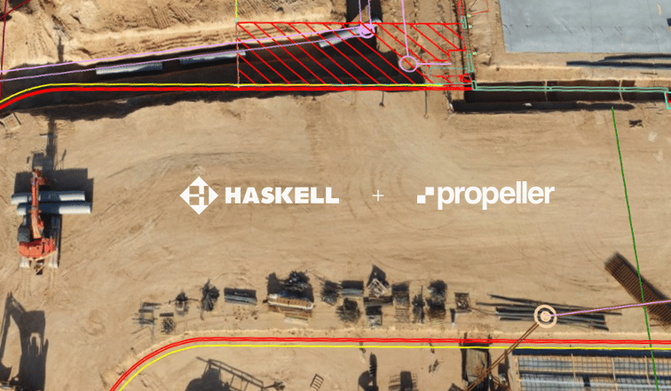
      How Haskell Uses Propeller to Manage Contractors on a Complex Worksite

      Haskell provides engineering, design, and building solutions for industrial, commercial, government, and civil infrastructure markets.…

      How Colorado-based Lange Land is Leveraging Drone Data to Check Everything in Between

      Established in 2012, Lange Land Surveys (LLS) is a full service land surveying company in…

      Abax First in Australia with Propeller-Powered Trimble Stratus

      Abax Contracting Pty. Ltd. has reaffirmed its leadership in state of the art construction services…

      Ready to learn how Propeller can power up your worksite?

      We’re happy to show you how Propeller can power your worksite, and boost productivity.

      Related articles

      Drones for Good: Propeller Helps Charity Organization in Kenya Survey New Development Site

      One of Propeller’s customers has recently proven that drones are not only delivering numerous commercial…
      Drone pilot in hi-vis flying a drone next to a crane, with an AeroPoint on the floor.

      Things To Know About Ground Control in Drone Surveying

      Ground control is the go-to option for turning drone data into highly accurate, survey-grade models.…
      A surveyor laying an AeroPoint on the ground stood next to a car.

      5 Ways to Use Your AeroPoints Sets

      AeroPoints™, Propeller’s smart ground control points, were designed to be used in five different ways.…