
Accuracy is everything to survey managers. Being able to confidently communicate the lay of the land on a construction site, cell progress on a landfill, or pit depth of a mining site is critical to the value surveyors offer an organization. Inaccurate surveys not only result in costly miswork— they lead others to mistrust of future work.
It’s those risks that cause some apprehension when considering whether to adopt new technologies and workflows like drone surveying.
Drone technology and photogrammetry have become more commonplace within the site surveying community over the past few years, but it’s still a relatively new technology. Because of this, there are still some survey managers who are skeptical about its capacity to provide accurate measurements.
This resistance has nothing to do with an unwillingness to learn new workflows—the industry’s embrace of tools like robotic total stations and 3D laser scanning over the past few decades proves that.
Instead, we believe survey managers (and those around them) who are skeptical of drones simply haven’t seen the proof that they can produce the same level of accuracy as traditional methods.
And it’s our job to work with them to show them that they’re wrong.
Unlocking the power of PPK
Post-processing kinematics (PPK) is our secret weapon at Propeller. It’s not a single technology or piece of hardware, but instead, a workflow that pulls several components together in concert.
If you haven’t heard about our PPK workflow before, you can check out a more in-depth explanation here. But, in short, the workflow consists of:
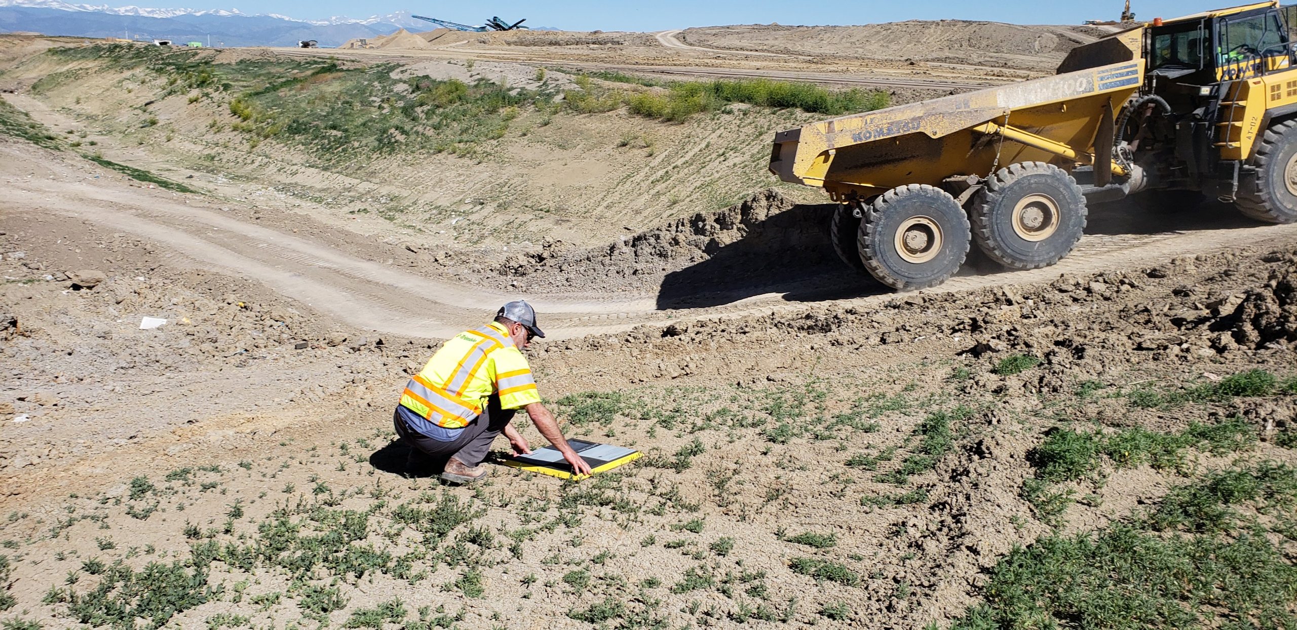
- Placing and turning on your GPS-enabled AeroPoint(s) to use as smart ground control points. They collect positional data from the ground. One AeroPoint serves as the base station for the others to correct themselves against.
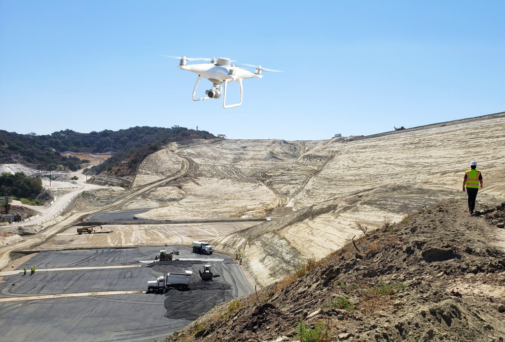
- Flying a PPK-enabled drone (like DJI’s Phantom 4 RTK) on your site to geotag images as they’re captured during flight.
- Uploading your drone and AeroPoint data to the Propeller Platform, where our we process them into an actionable 3D map of your site within 24 hours.
What does the Phantom 4 RTK have to do with PPK?
Comparing PPK to real-time kinematics (RTK) often brings about more confusion than clarity because it’s neither an “apples to apples” or “apples to oranges” comparison. Instead, you should think of RTK as a piece of the PPK puzzle.

We realized early on that, contrary to popular opinion, surveying with RTK drone technology would never (and we mean never) result in the same level of accuracy or consistency as surveys conducted with high-power, high-precision tools like the base and rover.
Thinking of RTK drones as an alternative to traditional surveying only leads to unfulfilled accuracy promises, and actually devalues the profession of surveying as a whole.
To overcome these accuracy issues, we returned to the drawing board, and here’s what we know now: When you take the geotagged images that your drone captures and correct the positional data against a base on the ground (that’s also recording GPS data), you wind up with a final output that’s accurate within centimeters.
PPK is the collision of these two datasets—aerial and ground-level GPS data collected and processed in tandem. It’s this combination that empowers our customers to reach 1/10ft (3cm) accuracy with drones.
How AeroPoints make verification a breeze
In most cases, If you’re using an PPK-enabled drone, only one AeroPoint is necessary to serve as your base station/GCP. (You can read more about the best ways to use your AeroPoints as GCPs here.)
Using additional AeroPoints as GCPs does increase accuracy—and is recommended if you’re surveying a site with significant elevation change or one that’s irregularly shaped—but at a certain point, the benefit of adding one more GCP becomes negligible. Depending on what you’re planning to use your models for, the difference between 1/8ft (4cm) and 1/10ft (3cm) accuracy may not be critical.
If that’s the case, you may find that using AeroPoints as checkpoints rather than ground control will be a greater benefit.
Unlike when they serve as GCPs, AeroPoints as checkpoints do not impact the accuracy of the survey. Instead, the AeroPoints use their internal GPS to simply provide the northing, easting, and elevation coordinates of where they are placed. Users can then do a spot check in the Propeller Platform to check the relative accuracy between the checkpoint and the same point surveyed by the drone.
In addition to giving your team confidence that they’re working off of reliable data, it can also alert you to data inaccuracies caused by poorly placed AeroPoints, letting you establish smarter GCP placement before costly rework is needed.
Integrating base and rover verification into the workflow
While we are big believers in the value of drone surveying and photogrammetry, we know that measurements collected through these means tend to be no more or less accurate than data gathered with a base and rover. The primary benefit of drones comes not from increased accuracy, but from the hours—or days—it saves survey managers who no longer have to walk an entire site to topo it.
In other words, drones are not a replacement for surveyors; they are simply another tool in the surveyor’s toolbox.
Because, as we’ve established, survey managers are fans of redundancy, many of our customers choose to adopt a hybrid approach, especially when surveying a new site. They want to be able to verify that the measurements they view in the Propeller Platform match up with the measurements they collect through trusted and true ground-based tools.
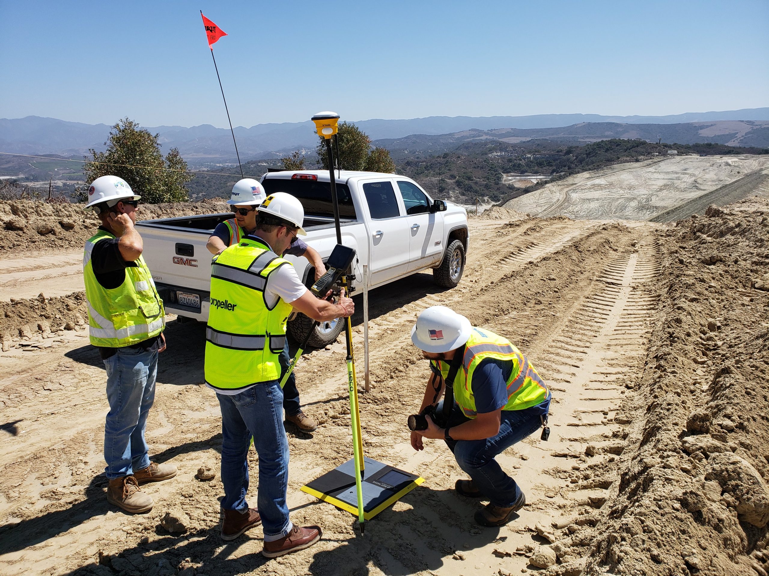
Propeller makes comparing our drone-generated maps to surfaces generated with other surveying software, like Trimble Business Center, incredibly easy. Users simply have to drag and drop a surface file type (such as a .DXF or .TTM) into the Platform, and use our Volume Compare tool to verify that the two layers are copacetic.
Sharable accuracy reports every time you process with Propeller
The final step of our Propeller PPK workflow is to upload your drone-collected images and AeroPoint data into the Propeller Platform for processing. We won’t go into all the benefits of our processing workflow here, but suffice it to say, it’s cheaper, safer, and more time-effective than self-processing.
Still, we regularly hear from those who are skeptical of handing the processing reins over to us. Survey managers can, understandably, be protective over their data, as can other decision-makers in an organization, like estimators, engineers, and managers.
One way we try to overcome that—besides spotlighting some of the successes our customers have had switching over from self-processing—is to provide a detailed processing report every time we generate a survey. These reports include a lot of insights into our processing…process. Some key details include:
- Quality metrics for each drone-collected image
- Expected ground control accuracy
- Difference between provided GCP/checkpoint elevation against the final Digital Elevation Model (DEM)
With these reports, our goal isn’t just to make our methods more transparent to survey managers—we also want to arm them with a piece of evidence they can use to quell higher-ups’ concerns about third-party processing. In fact, in our recent conversation with D.H. Griffin survey manager Keith Taylor, he told us that he submits each of our processing reports to his estimation department.


