At Propeller, our customers have always been our top priority—and that goes double when it comes to developing new products and features. After all, there’s no better resource when it comes to making Propeller better than the people who use it every day.
What that means is that the Propeller Platform and our PPK worksite management solution are never “done.” We’re lucky enough to have customers willing to talk to us about capabilities that would make Propeller even better—and we listen!
Read on for our highlights from 2021 (so far), from new Propeller Platform features to unique ways we can engage with and educate our customers.
Composite Surveys: streamline mapping of large-scale worksites
Composite surveys are the release we’re most excited about this quarter. They’re a game-changer for large worksites like mining or roadwork projects, and unique to the Propeller Platform.
A composite survey is a single 3D model composed of multiple smaller surveys conducted at different times and then stitched seamlessly together. This makes it possible to fly a small, active section of your worksite and merge that data with older surveys in the Platform to form a complete and up-to-date view of the whole site, without having to fly the entire site every time.
Think of composite surveys as fully automated image stitching. Collect aerial imagery from small, active sections of a large worksite as they change, and combine them with older images from inactive sections to form a meaningful whole.
This way, you get a complete view of your worksite and all its moving parts—without spending hours (or even days) conducting full-site surveys or wading through massive, cumbersome datasets.
Finally, large worksites get the up-to-date 3D model they’ve been asking for—in just a fraction of the time!
What can composite surveys do for you?
- Create and view a complete model of your site by merging up to 25 surveys using a simple workflow.
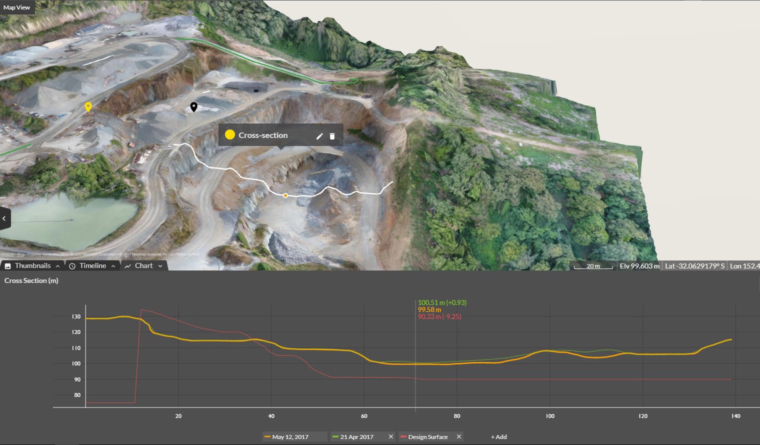
- Measure and track progress against previous survey data and final grade across the entire site using the Propeller Platform’s measurement tools.
- Calculate volumes and measure distance in just a few clicks, visualize against design, and document progress.
- Empower others on-site by providing easy access to an unlimited number of users.
- Update your composite 3D maps as your worksite changes.
LandXML file compatibility
You asked, and we delivered! We improved our CAD interoperability with support for LandXML files this quarter, and the response has been enthusiastic.
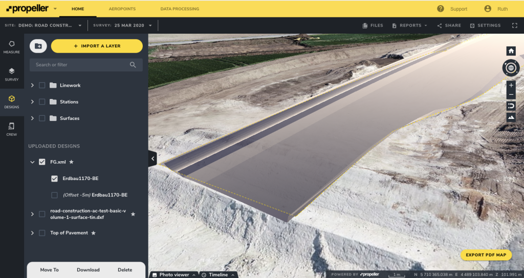
Now, you can export files from your preferred CAD package directly into Propeller without spending time on messy file conversions.
LandXML is a non-proprietary file format (.xml) that stores survey data used during the design and build process. Compatibility with LandXML makes government bids a breeze, since those contracts often stipulate LandXML as their required file format.
Survey managers and engineers can rest easy knowing that their design data can go straight into Propeller, with no cumbersome conversion step in between.
On-demand training to help you hit the ground running
Finally, in Q1 of this year we unveiled our on-demand series of training videos.
A pain point for almost anyone buying new software is the process of learning to use it. So, our Customer Success team put their ultra-knowledgeable heads together and created courses designed to make the Propeller onboarding experience as simple as possible. In addition to our team’s live support, our customers now have access to training videos packed with helpful information to help them hit the ground running.
Our training videos cover topics like:
- A Propeller Platform overview
- How to select a Coordinate Reference System
- Your first flight
- Mission planning with the Phantom 4 RTK
- AeroPoint essentials
Whether you’re new to drone surveying, new to Propeller, or an old hand at both, we’ve got content for you—from introductory tutorials to quick refreshers that will help you fine-tune your processes. Visit the Knowledge Base to watch them.

Keep an eye out for new content as we continue to add new videos and other information to our growing Knowledge Base over the coming months.