Reality capture process: How reality capture works step by step in construction

Read Time: 6 mins
Quick links
    Survey GPS ground control marker planted in rough earthworks terrain on a construction site

    Reality capture is the construction workflow of capturing, processing, and using digital site data to document what’s actually happening on your site. This guide breaks the process down step by step, from capturing data in the field with drones and other technologies to generating measurable outputs like orthophotos, 3D models, and surface comparisons back in the office. The real payoff comes from making it a repeatable workflow, giving teams consistent visibility, faster reporting, and tighter field-to-office coordination throughout a project.

    Every construction site tells a story that changes by the day: dirt moves, grades shift, stockpiles grow and shrink, and work gets built to design. The challenge has always been keeping an accurate record of that story without slowing the site down to do it. Reality capture solves that by turning the physical state of your site into digital data your whole team can measure, compare, and act on. Instead of relying on memory, scattered photos, or the occasional survey visit, you get a clear, current picture of the ground you can trust. Here’s how the process works, and how to make it a repeatable part of your workflow.

    What is the reality capture process?

    The reality capture process is the workflow of capturing, processing, and using digital site data to understand real-world project conditions.

    At its simplest, it takes the physical state of your site and turns it into information your team can act on. Construction teams use it because the alternative, relying on memory, scattered photos, or infrequent survey visits, leaves too much room for guesswork. When you can see exactly what the site looked like on a given day, you can plan, bill, and report with confidence.

    The real value comes from connecting the field to the office. Data captured on site flows straight into the hands of the people making decisions, so there is no lag between what is happening on the ground and what leadership sees on screen. In construction, reality capture supports more accurate construction site planning by giving teams a clear record of current site conditions.

    There is also a difference between one-time documentation and a repeatable workflow. A single capture tells you about one moment. A repeatable process tells you how the site is changing over time, which is where the real insight lives.

    How does reality capture work? A step-by-step process

    Reality capture works by turning physical site conditions into digital information that teams can measure, compare, and share. Here is how the process breaks down.

    Step 1: Define the project scope and data needs

    Before choosing tools or workflows, get clear on what you actually need to capture. Are you tracking progress, comparing surfaces to design, measuring volumes, documenting site conditions, or reporting to stakeholders? Each goal shapes how often you capture data and what outputs matter most. Defining scope first saves you from capturing data you will never use.

    Step 2: Capture site data

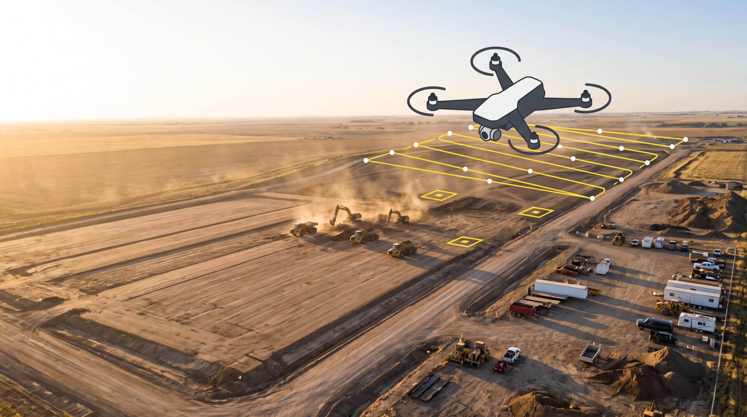
    Site data can be captured using drones, cameras, GPS systems, laser scanning, machine tracking, or other reality capture technologies. The right method depends on your site, your timeline, and the level of detail you need. Drone-based capture may also use drone photogrammetry workflows to turn aerial imagery into measurable site models.

    Step 3: Process and align the data

    Once captured, the raw data is processed, georeferenced, and aligned so it accurately represents the site. This is the step that turns a pile of images or scan points into usable visual and spatial outputs. Good processing means your data lines up with real-world coordinates, so measurements you take later hold up.

    Step 4: Generate reality capture outputs

    Processing produces the outputs your team works with: orthophotos, point clouds, 3D models, surface comparisons, measurements, and reports. These are the deliverables that make the data useful, whether you are checking a volume or comparing today’s surface to the design. For a deeper breakdown, review Propeller’s guide to drone survey outputs.

    Step 5: Analyze and share results

    With outputs in hand, teams put the data to work: tracking progress, planning next steps, comparing actual conditions to design, reporting to stakeholders, and keeping field and office teams coordinated. This is where reality capture stops being a record and starts driving decisions. The faster these outputs reach the right people, the faster the site can move.
    What types of reality capture data are produced?

    Reality capture data includes the visual, spatial, and operational information generated from site capture workflows. A single capture can produce several types of data at once, each serving a different purpose.

    Site imagery gives you a visual record of conditions on a specific day. Orthophotos correct that imagery so it is geometrically accurate and measurable. 3D models let you explore a digital version of the site in three dimensions. Surface comparisons show how the ground has changed between captures or against a design. Volume measurements quantify material moved or stockpiled. Progress reports pull it all together into something you can share with stakeholders. Together, this data gives teams a complete and high-precision picture of the site, not just a snapshot.

    Reality capture technologies used in construction

    Construction reality capture often combines several technologies to document site conditions accurately and consistently. No single tool does everything, so the strongest workflows layer them together.

    Drone mapping covers large areas quickly and feeds aerial imagery into measurable models. Aerial imaging captures the visual detail that anchors those models. GPS and ground control tie everything to accurate real-world coordinates. LiDAR or laser scanning adds detail in vegetated or obstructed areas where standard imaging struggles. Machine tracking brings in operational data from the equipment already working on site. Cloud-based visualization platforms then pull all of these inputs into one shared view everyone references, so the data is not stranded in separate tools.

    The point is not which technology is best on its own. It is how they work together to give you a consistent, reliable record of the site.

    3D reality capture in construction use cases

    3D reality capture in construction helps teams understand what is happening on site and compare current conditions against project plans. Because the data is spatial and measurable, it supports a wide range of practical jobs.

    Teams use it to monitor earthworks progress, verify completed work, track material movement, and compare actual conditions against design. It strengthens stakeholder reports by backing claims with current data, and it improves field-to-office communication by giving both sides the same reference point. Over a project’s life, it also builds a documented history of site conditions, which is invaluable when questions or disputes come up later. Reality capture data can also support construction daily reporting software by providing updated visual and operational site information.

    Benefits of a repeatable reality capture process

    The biggest gains come when reality capture becomes a routine, not a one-off. A repeatable process compounds in value the longer you run it.

    Better site visibility

    A repeatable reality capture process gives teams a consistent view of current site conditions and project progress. Instead of guessing what the site looks like between visits, you have a reliable record you can check any time, which keeps everyone working from the same facts.

    Faster reporting and verification

    With accurate digital site records, teams can cut back on manual documentation and verify work far more quickly. What used to take days of back-and-forth becomes a quick check against the data, freeing your team to focus on the work itself.

    Stronger project coordination

    Centralized reality capture data helps field teams, office teams, and stakeholders stay aligned throughout the project lifecycle. When everyone references the same record, fewer details fall through the cracks and decisions move faster. Many teams combine reality capture with topographic surveying workflows to support grading analysis and earthworks tracking.

    Challenges and considerations for reality capture workflows

    Reality capture pays off, but a few practical factors shape how smoothly it runs. Capture frequency matters: too infrequent and you miss changes, too often and you create data you will not use. Site conditions like dust, active equipment, or large footprints affect what method works best. Weather can limit drone flights and outdoor capture, so timing counts. Data management becomes important as captures add up, since the value is in being able to find and compare them. And processing timelines affect how quickly outputs reach your team, which is why offloading processing to a platform keeps things moving. Planning around these factors up front keeps the workflow practical and dependable.

    Making reality capture actionable in construction

    Reality capture is most valuable when it becomes a repeatable workflow, not a one-time documentation exercise. When teams capture, process, and use site data on a regular cadence, they gain consistent visibility, faster reporting, tighter coordination, and better operational decisions. The data stops being a record of the past and starts shaping the next day’s work.

    Frequently asked questions

    What is the reality capture process?
    The reality capture process is the workflow of capturing, processing, and using digital site data to understand real-world construction conditions. It turns the physical state of a site into measurable, shareable information teams can act on.

    How does reality capture work in construction?
    It works in five steps: define what you need to capture, capture site data using drones or other technologies, process and align that data, generate outputs like orthophotos and 3D models, then analyze and share the results for tracking, reporting, and decisions.

    What is reality capture data?
    Reality capture data is the visual, spatial, and operational information produced from site capture, including site imagery, orthophotos, 3D models, surface comparisons, volume measurements, and progress reports.

    What are the benefits of 3D reality capture in construction?
    3D reality capture improves site visibility, speeds up reporting and verification, and strengthens coordination between field and office teams. As a repeatable workflow, it gives teams an accurate, current record they can use to track progress and compare against design.

    Quick links

      Related articles

      DJI M3E hovering

      Drones in construction: A beginners guide

      New to using drones in construction projects? Start here. Drones have never been more affordable…

      7 road design tools that speed up your next project

      Road design and planning is a juggling act. You’re balancing job requirements and physical limitations…

      Promoting Sustainability in Earthworks with Drone Technology

      Drone surveying is quickly becoming an integral part of many construction and civil engineering projects. …

      Ready to learn how Propeller can power up your worksite?

      We’re happy to show you how Propeller can power your worksite, and boost productivity.

      Related articles

      Drone pilot in hi-vis flying a drone next to a crane, with an AeroPoint on the floor.

      Things To Know About Ground Control in Drone Surveying

      Ground control is the go-to option for turning drone data into highly accurate, survey-grade models.…
      DJI M4E flying in the sky

      Propeller’s Drone Guide: DJI Solutions for Commercial Operations

      At Propeller we love testing new drone hardware and we are processing hundreds of drone…

      Telecom Tower Inspection using DJI Phantom 4 Pro: Step-by-Step Guide

      A few weeks ago a new DJI Phantom 4 Pro was delivered to our office.…