Best drone services for construction

Read Time: 7 mins
Quick links
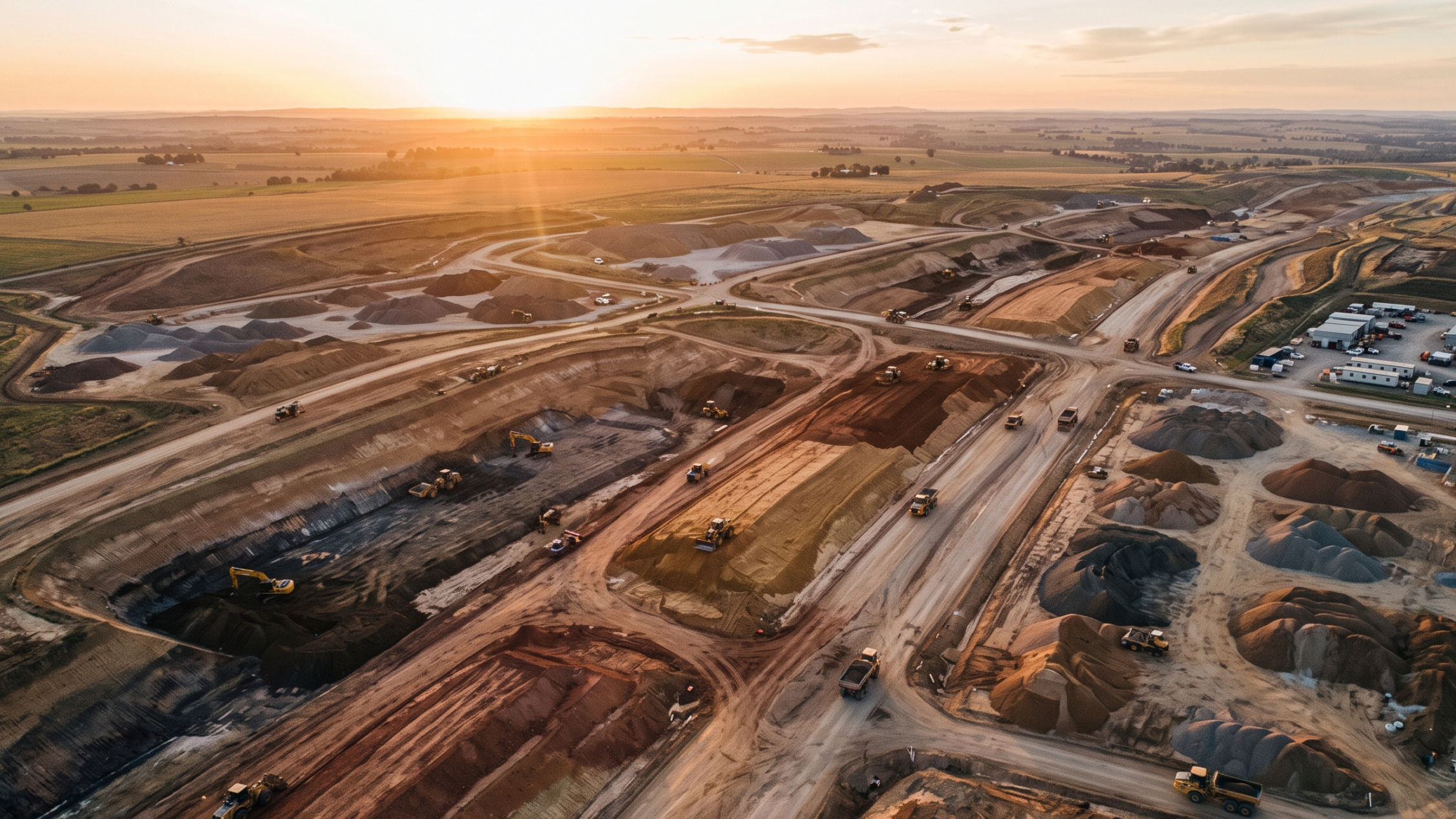
    Aerial view of a large active earthworks construction site showing graded terrain, haul roads, and material stockpiles

    Construction drone services capture site data, measure earthworks, and turn both into reporting teams can act on, giving project managers a timestamped record of what changed and when. This guide covers what those services include, what deliverables to expect, and how to evaluate providers on accuracy, reporting, real-time tracking, and workflow fit.
    Construction drone services provide aerial data collection, site mapping, earthworks measurement, and reporting that help project teams monitor progress, manage subcontractors, and make faster, more accurate decisions. This guide explains what construction drone services include, what deliverables to expect, and how to evaluate providers based on the capabilities that actually matter for project outcomes.

    Construction projects generate more site data than most teams can act on. Drone services have become one of the most practical ways to close that gap, giving project managers, superintendents, and site teams the visibility they need to make decisions before delays and disputes get expensive.

    But not all construction drone services deliver the same value. The difference is rarely the drone. It is the data platform behind it: how accurately site conditions are captured, how quickly that data becomes available, and how well it integrates into the workflows project teams already use.

    This guide covers what construction drone services include, what deliverables to expect, and what to look for when evaluating providers.

    What are drone services for construction?

    Construction drone services provide aerial data collection, site mapping, measurement, reporting, and analytics to support project planning and execution.

    In practice, that covers a wide range of workflows: capturing a weekly progress record across a large site, generating volume calculations for a pay application, documenting buried utilities before backfill, or giving a remote owner a clear picture of what is happening on the ground.

    Core capabilities include:

    Drone surveying: High-precision aerial surveys processed into orthophotos, terrain models, and point clouds
    Progress tracking: Regular site captures showing how a project has changed over time
    Earthworks measurement: Volume calculations for cut/fill, stockpiles, and material movement
    Reporting: Site-specific reports for owners, subcontractors, and project teams
    Construction data analytics: Insights drawn from site data to support decision-making

    Understanding what is included, and what is not, helps teams evaluate providers before committing to a program. A useful starting point is understanding the full range of drone survey outputs a platform can deliver and how those outputs connect to your existing project tools.

    Why construction companies use drone services

    Construction companies use drone services to improve project visibility, reduce manual work, and make faster decisions using accurate site data.

    Traditional surveying provides accurate data, but rarely at the pace modern construction projects demand. A crew stretched across multiple sites may survey a project once a week. A site that changes daily can accumulate days of undocumented conditions.

    Drone services change the math. Regular aerial surveys, weekly, twice-weekly, or daily on high-activity sites, give teams a consistent, timestamped record they can measure, compare, and share.

    The operational benefits are well established:

    Better visibility: Teams can see the full site from any device, at any time, without a site visit
    Faster measurements: Volume calculations and progress reports that once took days can be completed in hours
    Subcontractor accountability: Design overlays and progress comparisons make it straightforward to verify whether work has been completed as specified
    Improved stakeholder communication: Remote owners and executives can see current site conditions without scheduling a walk

    Hamzah Shanbari, Technology & Innovation Manager at Haskell, described the impact directly: “Propeller helped us recognize issues with the work our subcontractors were doing and correct them before they became expensive.”

    Read the Haskell story.

    Types of construction data delivered by drone services

    Drone services generate visual, spatial, and operational data that supports planning, reporting, and project management.

    Site imagery and progress documentation

    Orthophotos and site imagery give teams a high-resolution, measurable aerial view of the site at a specific point in time. Captured regularly, they build a timestamped progress record, one of the most defensible forms of documentation for pay applications, change orders, and dispute prevention.

    Survey and mapping data

    Beyond imagery, drone surveys produce terrain models, point clouds, and digital elevation data. These outputs feed directly into design conformance checks, cross-section analysis, and cut/fill comparisons. The best providers deliver these outputs as part of a standard workflow, not as add-ons, through a consistent survey processing pipeline.

    Earthworks and volume measurements

    For earthworks and heavy civil projects, volume calculations are one of the highest-value deliverables. Accurate stockpile quantities, cut/fill tracking, and material movement data directly support billing accuracy, schedule management, and bid verification.

    Construction data analytics

    The most capable platforms go beyond measurement to provide analytics: production trends, progress heatmaps, and design deviation reports. These tools help project teams identify issues before they become costly, and give leadership the visibility they need to manage across multiple sites. Propeller’s daily reporting tools are built around this kind of operational intelligence.

    What to look for in a construction drone service provider

    The best drone service providers deliver accurate data, actionable insights, and workflows that support construction decision-making, not just aerial imagery.

    When evaluating providers, prioritize these criteria:

    Data accuracy: What survey methodology is used? Does the platform support PPK drone mapping or RTK corrections and AeroPoints ground control? Accuracy claims should come with a documented methodology
    Reporting capabilities: Can the platform generate the specific reports your team needs (pay app support, progress summaries, stockpile reports), and how quickly are outputs available after a flight?
    Site monitoring tools: Does the platform support design overlays, timeline comparison, and change detection? These are the tools that turn aerial imagery into operational intelligence
    Construction-specific expertise: Does the provider understand construction workflows, coordinate reference systems, and how drone data integrates with CAD and design tools?
    Scalability: Can the platform support a single-site program and scale to enterprise deployment? Mortenson Construction operates 42 certified pilots running 16 drones across the US, processing survey data at 900% the volume they handled when the program launched in 2021. Reports that used to take a full day or a week now take minutes. Read the story
    Integration with existing workflows: Can drone data flow into your existing project management, CAD, or reporting tools? Drone data that requires a separate process to interpret rarely gets used at full value

    Drone services vs building an internal drone program

    Some construction companies outsource drone services while others build internal programs, and many use both.

    Outsourced drone services are a strong starting point for companies that want site data without building the internal expertise to capture and process it. A service provider handles equipment, flight operations, processing, and delivery. The tradeoff: less control over scheduling, frequency, and workflow customization.

    Internal drone programs give teams direct control over when and how sites are surveyed. Teams can fly on their own schedule, respond to site conditions in real time, and build institutional knowledge around their data. The tradeoff: upfront investment in equipment, training, and ongoing operational overhead.

    Hybrid approaches are increasingly common. A company might run an internal program for its most active sites and contract out to a service provider for sites that don’t justify permanent drone resources. PPK drone mapping capabilities that reduce dependence on ground crews make internal programs more accessible to teams without dedicated survey staff.

    The right model depends on project scale, survey frequency, available expertise, and budget. There is no universally correct answer, only what fits the operational reality of a specific team.

    How drone services improve construction site management

    Drone services improve construction site management by providing accurate, timely information that supports planning, coordination, and project tracking.

    The impact is felt across multiple roles and workflows:

    Progress monitoring: Site managers can compare current conditions against the design model and against previous surveys without a site walk
    Site coordination: Subcontractors and GCs work from the same aerial record, reducing miscommunication and disputes over completed work
    Material tracking: Stockpile volumes and material movement are measured and documented, supporting accurate billing and inventory management
    Stakeholder communication: Field collaboration tools give remote owners and executive teams a clear, current view of site conditions, accessible on any device
    Risk reduction: Issues identified early (a subgrade deviation, a utility conflict, a quantity discrepancy) are resolved before they escalate. The cost of finding a problem early is almost always less than the cost of finding it late

    The shift from reactive to proactive site management is where drone services deliver their greatest value. Teams that fly regularly and act on what they see consistently outperform teams that rely on periodic site walks and manual reporting.

    Beyond drone surveys: the rise of construction intelligence platforms

    Modern construction teams increasingly use drone data alongside analytics and reporting platforms to improve operational performance, not just capture aerial imagery.

    The most capable platforms function as construction intelligence systems: centralizing data from aerial surveys, machine telematics, and field tools into a single shared map the whole team works from.

    Capabilities that distinguish intelligence platforms from basic drone services:

    Data centralization: All survey data, design files, machine data, and progress records in one place, accessible from any device
    Automated reporting: Regular reports generated automatically from survey data, reducing the manual overhead of documenting progress
    Site analytics: Production trends, volume tracking, and progress heatmaps that give teams operational visibility beyond what imagery alone provides
    Decision support: The ability to answer specific questions directly from the platform: how much material moved this week? Is this pad on grade? Where are we behind schedule?

    These are the capabilities that separate a drone mapping tool from a platform that helps construction teams manage and protect their projects. For teams evaluating providers, the question is not just who flies the drone; it is what the team can actually do with the data.

    Explore Propeller’s construction reporting workflows to see how site data connects to the decisions that matter.

    Choosing the right construction drone service

    The best drone services help construction teams collect accurate site data, improve visibility, and make better project decisions through analytics and reporting.

    Successful construction drone programs are about more than aerial imagery. The greatest value comes from turning construction data into actionable insights: measurements that support billing, comparisons that catch deviations early, and reports that give every stakeholder a clear picture of where the project stands.

    Choosing the right provider means asking the right questions: not just how accurate is the drone, but how fast is the data, how well does it fit our workflows, and what can our team actually do with it.

    Request a demo to see how Propeller helps modern construction site management and data analytics

    Frequently asked questions

    Construction drone services provide aerial data collection, site mapping, measurement, reporting, and analytics to support project planning and execution. Services range from one-time surveys to ongoing site monitoring programs.

    Teams use drone data for progress tracking, volume calculations, design conformance verification, pay application support, subcontractor management, and stakeholder communication.

    Drones can capture orthophotos, terrain models, point clouds, and volume data. Combined with a construction analytics platform, this data supports measurements, reporting, design overlays, and timeline comparisons.

    For most active construction sites, yes. The cost of regular drone surveys is typically offset by time savings in surveying and documentation, and by the cost of issues caught early rather than late.

    Prioritize data accuracy, reporting capabilities, site monitoring tools, construction-specific expertise, scalability, and integration with existing project workflows.

    Yes. Regular, accurate site data helps teams monitor progress, coordinate subcontractors, track materials, communicate with stakeholders, and reduce risk across every phase of a project.

    Quick links

      Related articles

      Better blast planning, monitoring and quarry reporting using drone data

      Propeller gives mining teams accurate pre- and postblast site data by combining high-precision drone surveys…

      Six smart ways to use drones in mines and quarries

      The use of drones in mines and quarries is common, but these sites are highly…

      Cross section survey in a matter of minutes using drone data

      With the power of drone-captured data and the Propeller Platform, surveying cross sections becomes as…

      Ready to learn how Propeller can power up your worksite?

      We’re happy to show you how Propeller can power your worksite, and boost productivity.

      Related articles

      Drone pilot in hi-vis flying a drone next to a crane, with an AeroPoint on the floor.

      Things To Know About Ground Control in Drone Surveying

      Ground control is the go-to option for turning drone data into highly accurate, survey-grade models.…
      DJI M4E flying in the sky

      Propeller’s Drone Guide: DJI Solutions for Commercial Operations

      At Propeller we love testing new drone hardware and we are processing hundreds of drone…

      Telecom Tower Inspection using DJI Phantom 4 Pro: Step-by-Step Guide

      A few weeks ago a new DJI Phantom 4 Pro was delivered to our office.…