Concept design vs. detailed design: What construction teams need to know

Read Time: 6 mins
Quick links

    Concept design and detailed design serve different decisions. Concept design, built on real terrain, establishes feasibility before engineering begins. Detailed design is what a qualified engineer certifies for construction. Propeller CAD is a concept design tool that generates 3D earthwork designs from plain-language prompts on actual drone survey terrain, then exports DXF/TTM for engineering handoff. It complements Civil 3D and 12D without replacing them.
    Most teams know that concept design and detailed design are different things.

    But when both happen in the same conversation, the lines blur fast. That’s where costly rework starts.

    A concept design answers: could this work, roughly where, at roughly what cost? A detailed design answers: exactly how should this be built, certified by an engineer, and issued for construction?

    Treating a concept as a finished design creates problems. So does waiting for final engineering before you have any answer to give a client. The two stages exist for a reason: they serve different decisions, different audiences, and different levels of verification.

    This guide explains the distinction clearly: what each stage involves, what belongs in each one, and where tools like Propeller CAD fit in that workflow without overstepping into certified design territory.

    What is concept design?

    Concept design is the first stage of any earthwork project. It’s where you explore whether an idea is feasible before you commit engineering resources to it.

    At this stage, you’re not trying to get every elevation right. You’re trying to establish whether the site can support the idea: a haul road, a pad, a retention pond, an access ramp, and what it will roughly involve in terms of cut, fill, and logistics.

    What concept design includes

    The purpose of a concept design

    Rough geometry on real terrain

    A 3D shape that sits on the actual site surface, enough to show whether the idea makes spatial sense.

    Approximate earthwork volumes

    Enough to estimate whether this is a small cut or a major earthworks event. Not certified quantities.

    Stakeholder communication

    A visual that lets a client, PM, or crew understand what’s being proposed before engineering begins.

    The key constraint of concept design is that none of these outputs are certified. They’re directional. A concept design is a starting point for a conversation, not a deliverable an engineer stamps. That’s not a limitation. It’s the point. Concept design exists to make the engineering conversation faster, cheaper, and better informed.

    What is detailed design?

    Detailed design is where the concept becomes a certified deliverable. This is the work done by qualified engineers using tools like Civil 3D, 12D, Trimble Business Center, or Agtek. It produces the design that gets stamped, issued for construction, and governs the work on the ground.

    Detailed design includes:

    • Engineered surfaces and alignments: exact geometry, grades, and cross-sections built to spec and issued for construction
    • Certified earthwork volumes: quantities verified by a qualified engineer for pay applications, bid documentation, and contractual purposes
    • Regulatory and compliance documentation: plans, specifications, and drawings that satisfy legal, permitting, and approval requirements
    • Signed-off deliverables: outputs that carry professional engineer certification and can be used in legal or contractual contexts

    This is not iterative. Getting to detailed design takes time, cost, and specialist expertise, which is exactly why concept design exists first. You don’t want to spend engineering resources on a concept that hasn’t cleared basic feasibility on actual terrain.

    The handoff between stages

    The transition from concept to detailed design is where information needs to flow cleanly. If the concept is too rough, the engineer has to start over. If the concept was developed on the wrong terrain or against the wrong assumptions, the detailed design inherits those problems.

    That’s why the best concept designs are built on real site data. When a concept is generated against actual drone survey terrain, the same surface the engineer will work from, the handoff is cleaner. The engineer can see what they’re working with. The concept dimensions are grounded. The gap between “what we sketched” and “what the site actually looks like” is smaller.

    The design workflow

    From first idea to certified deliverable

    01

    Capture site terrain

    02

    Generate concept on real data

    03

    Review and iterate concept

    04

    Export DXF to engineering tools

    05

    Engineer certifies and issues for construction

    The concept-to-detailed-design handoff works best when the concept was built close to real site conditions. That’s what determines whether the engineering team inherits a head start or a problem.

    Where Propeller CAD fits in this workflow

    Propeller CAD is a concept design tool built into the Propeller platform. It’s designed for the concept stage: generating and iterating earthwork designs on your actual drone survey terrain, without requiring CAD expertise or external consultants for every iteration. Read the Propeller CAD 101 guide for a full walkthrough of what it can design.

    You describe what you want in plain language: a haul road from point A to B at 10% grade, a balanced pad at this elevation, a retention pond sized to this catchment area. Propeller CAD generates a 3D design on your real terrain, with approximate volumes, that you can review and adjust before anything goes to engineering.

    What Propeller CAD is for, and what it isn’t

    Use Propeller CAD for

    ✓ Haul road and pad concepts on real terrain

    ✓ Iterating design options before engineering begins

    ✓ Stakeholder visuals grounded in actual site data

    ✓ DXF/TTM export for engineering handoff

    Take to your engineer for

    → Certified or stamped design deliverables

    → Legally mandated quantity calculations

    → Final documentation for regulatory approval

    → Complex alignment or high-precision output

    This positioning is deliberate. Propeller CAD is not trying to replace Civil 3D or 12D for final design work. It fills the gap between “here’s a rough idea” and “here’s something the engineer can actually work from,” faster and on real terrain.

    Common mistakes that happen when stages blur

    When concept and detailed design get treated as the same thing, two problems surface repeatedly.

    Submitting a concept as a certified deliverable. Concept volumes are approximate by nature. Using them for pay applications, bid prices, or regulatory submissions without engineer certification creates liability and inaccurate commercial outcomes. The concept gets you into the right ballpark. It doesn’t cross the finish line.

    Waiting for final engineering before the concept is validated. Engaging a full engineering workflow on a concept that hasn’t been tested against real site terrain is expensive. You may get a certified design for a haul road that turns out to need a completely different route once the terrain is properly assessed. Concept design is the check that prevents this.

    The right question to ask: Does this output need to be certified, or does it need to be good enough to have an informed conversation? If the answer is the second one, you’re in concept design territory.

    The goal of concept design is not to skip engineering. It’s to arrive at engineering with a better starting point.

    See concept design on your site data

    Propeller CAD generates earthwork concept designs on your actual drone survey terrain. Read the Propeller CAD product page for a full look at what it can design, or explore the design conformance and as-built workflow to see how concept design connects to the full site cycle.

    Frequently asked questions

    Concept design establishes feasibility: roughly where something could go, at roughly what earthworks cost, using real terrain. Detailed design is what a qualified engineer produces for construction: certified geometry, stamped quantities, and regulatory documentation. The two stages serve different decisions and require different levels of verification.

    No. Concept design volumes are approximate and not certified by an engineer. Pay applications, certified bid quantities, and regulatory submissions require detailed design outputs produced by a qualified engineer using the appropriate tools. Use concept designs to inform the engineering conversation, not to replace it.

    No. Propeller CAD is a concept design tool. It fills the stage before your engineering workflow begins. When a design needs engineer certification, stamped documentation, or regulatory approval, those deliverables come from Civil 3D, 12D, or the equivalent tool used by your engineering team. Propeller CAD generates the concept that your engineer then takes into those tools.

    Propeller CAD exports DXF (compatible with Civil 3D, 12D, Agtek, and most engineering tools) and TTM (a terrain model format used in GPS data collectors and in-cab guidance systems). DXF is the standard format for engineering handoff; TTM is useful for getting a concept onto the ground ahead of final engineering review. See the Propeller CAD help guide for step-by-step export instructions.

    Before the engineering workflow starts. Concept design validates that an idea is feasible on real terrain before you commit engineering time and cost to it. The more concrete the concept, especially if it’s built on real drone survey data, the less time the engineer spends starting from scratch, and the fewer round trips between the office and the field.

    Quick links

      Related articles

      3 ways drones make mine reclamation easier

      Anyone who works in the mining industry will tell you that projects are anything but straightforward. Planning,…
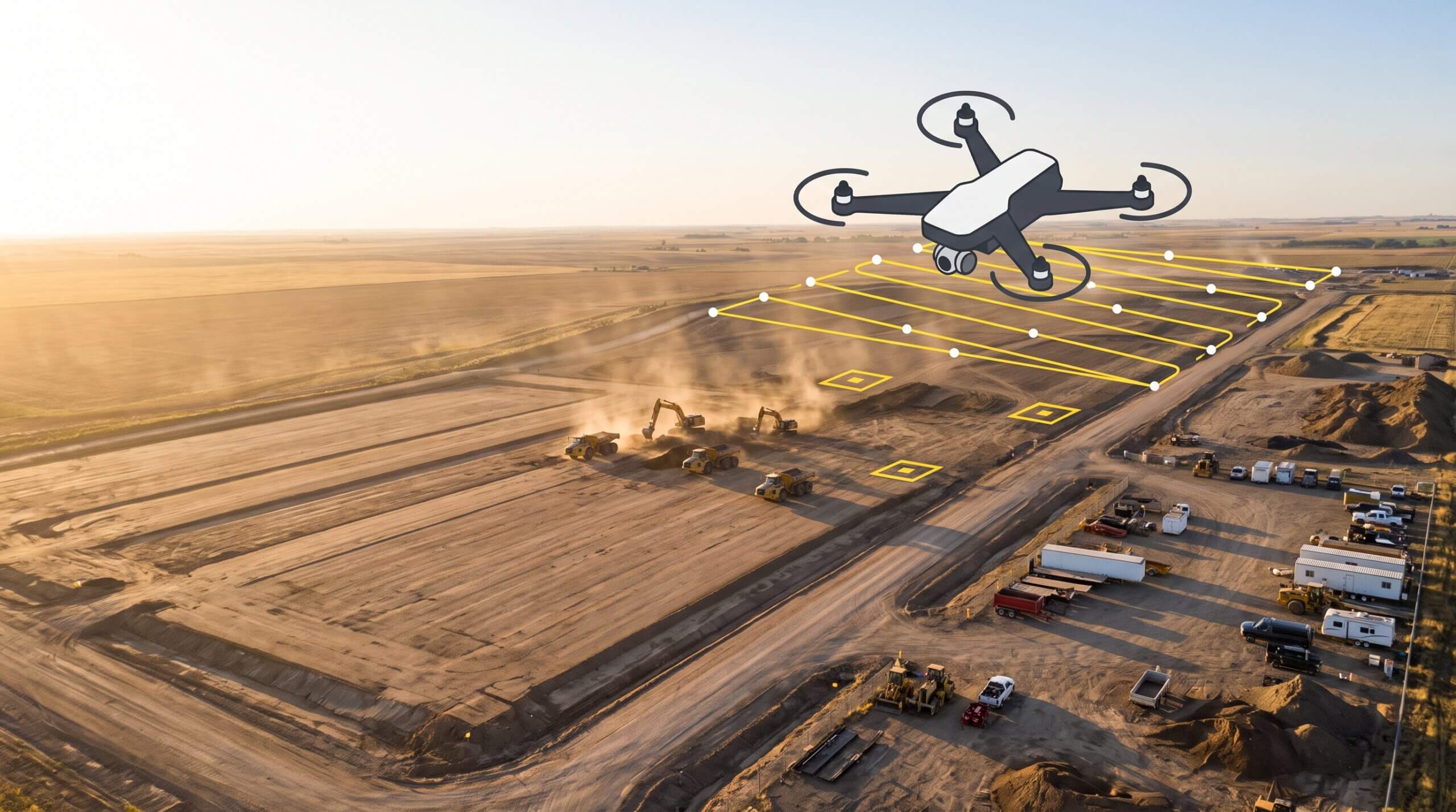
      Survey drone flying over an active earthwork site with an illustrated flight path, capture points, and ground control markers

      Propeller’s Drone Guide: DJI Solutions for Commercial Operations

      Propeller’s verified DJI lineup covers five platforms: from the compact Mavic 3 Enterprise and purpose-built…

      How to plan earthwork concepts using current site survey data

      Planning earthwork concepts on current site survey data, rather than stale topo or a blank…

      Ready to learn how Propeller can power up your worksite?

      We’re happy to show you how Propeller can power your worksite, and boost productivity.

      Related articles

      Measuring Cut and Fill in Mining and Aggregates

      The aggregates and mining industries are all about quantities—how much is sitting in your stockyard…

      2D or Not 2D? When to Use 2D and 3D in Your Site Modeling

      Technology for the construction, aggregates, and waste management industries has been expanding faster than ever,…
      Screenshot of a Propeller platform

      5 Civil 3D & Drone Data Workflows

      For designers and engineers, the ability to seamlessly combine drone data with their existing CAD…