How a family-owned contractor uses Propeller to improve every stage of the job, from first bid to final payout
About the project
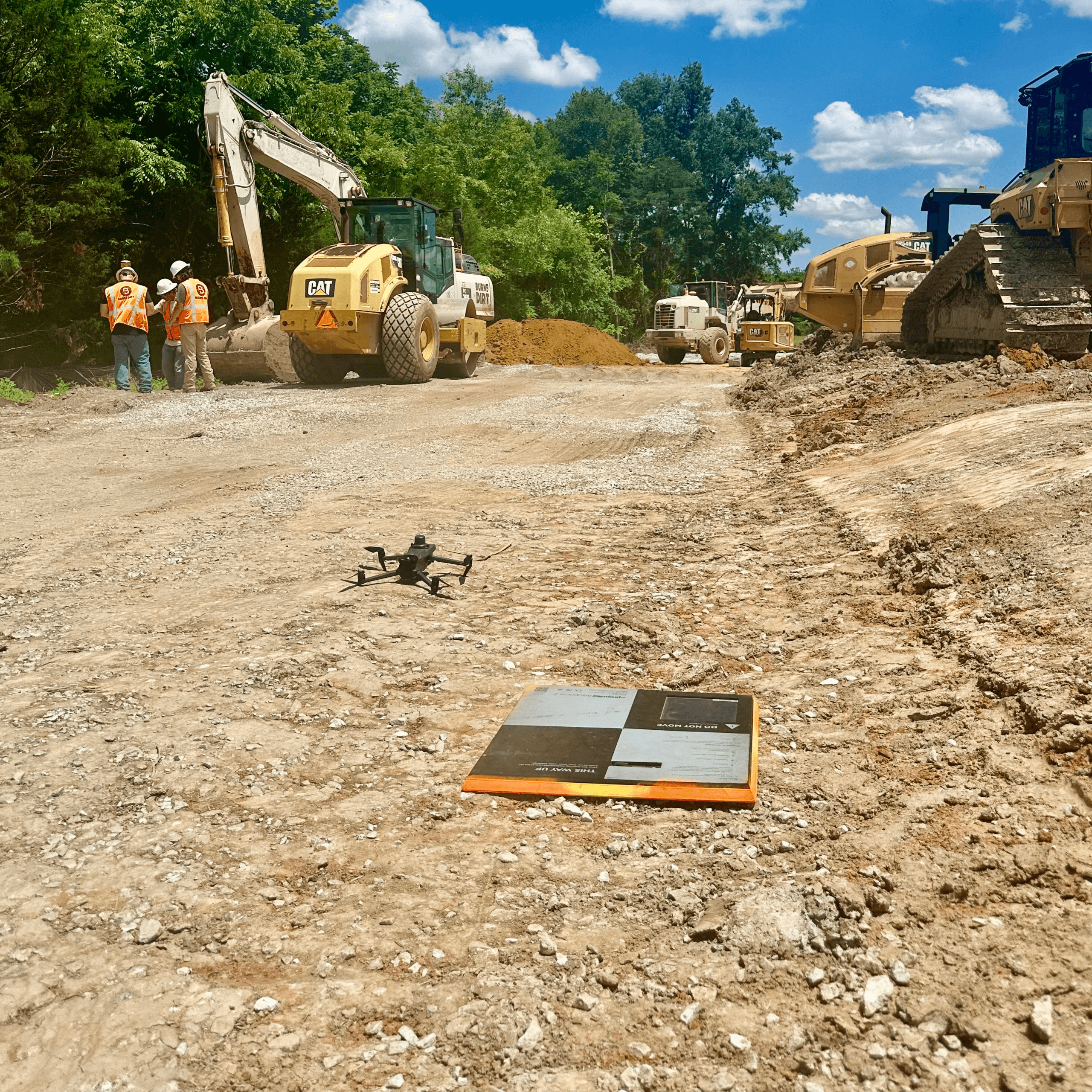
Burns Dirt is a family-owned civil earthwork contractor in Mississippi that doesn’t do anything halfway. Their bread and butter is mass haul and export, but they also self-perform drainage, utilities, and concrete, taking on everything from small private jobs to multi-million dollar DOT roadwork projects. Preston Sullivan, Director of Project Management at Burns Dirt, describes the work this way: “We pretty much do everything but go vertical.”
Running that kind of range, the margin for uncertainty is thin, and the cost of finding a problem too late is high. That’s why Burns Dirt has spent the last four years using Propeller to make every job they touch run more smoothly. From the pre-construction topo through final payout reconciliation, Preston’s team now plans, tracks, and proves their work in a single platform.
Before Propeller, Burns Dirt was running the same playbook most contractors still rely on today.
- Topography you couldn’t fully trust. Engineers would hand over a topo that “could be right, could be wrong.” The only way to know for sure was to send someone out with a base and rover to verify it manually…. when time allowed.
- Quantity tracking with truck tickets. On lump-sum jobs, tracking material quantities through truck tickets meant a lot of guesswork. “Several jobs you thought you were winning on, you were actually losing,” Sullivan said.
- No hard proof when disputes came up. Without a consistent record of what the site looked like at any given point, change order conversations at the end of a project could get messy.
- Estimating that relied on rough judgment. Burns Dirt gets a lot of design-build clients—the kind who show up with a napkin sketch and ask for a project estimate. Getting there meant working purely on gut feel. Any gap between the estimate and actual quantities would either crush their margins or risk a major dispute once dirt started moving.
Putting accurate data in the driver’s seat
Preston Sullivan had been on the job for about two weeks when the SITECH Tri-Rivers rep demo’d Propeller. A month later, they had it up and running. Four years on, it’s still going strong.
“Propeller has helped us tighten our bids up. It’s helped us track jobs throughout their life cycle.” —Preston Sullivan, Director of Project Management, Burns Dirt
Pre-construction was an immediate win. Burns Dirt can now fly a site in 15 minutes, process it, and hand the estimating team real topo data to work from. “We actually have raw data that we can use to build a very tight price for that owner,” Sullivan said. “That gets us in the driver’s seat.”
Speed has become their differentiator. When Burns Dirt walks into a presentation with a real-time flight overlaid with cut/fill data already on the screen, it changes the conversation. “That’s a seller right there,” Sullivan said.
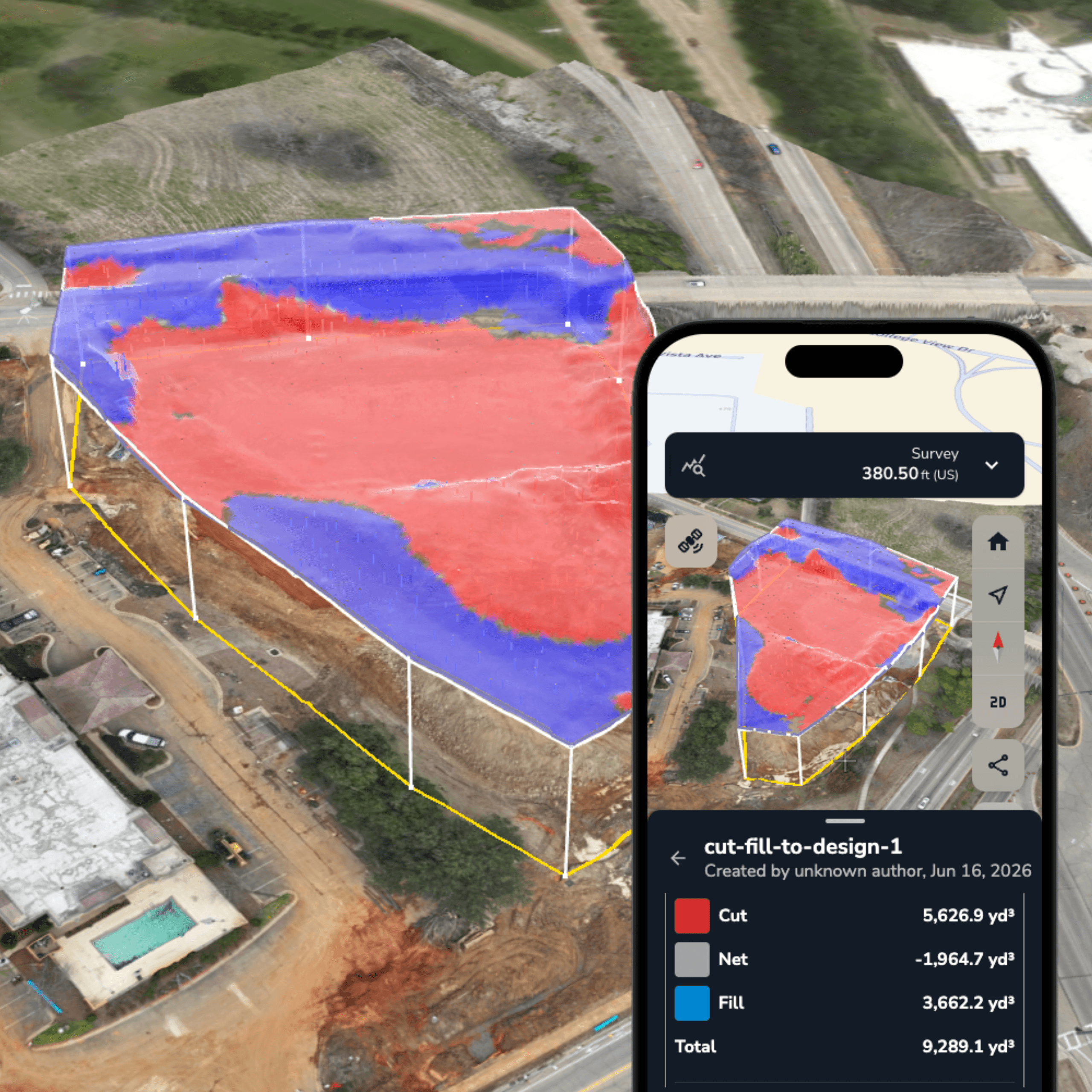
After a job is awarded, Burns Dirt uses Propeller as a running record. The team tracks multiple surfaces (subgrade, finish grade, and existing), comparing drone captures to design files throughout the project lifecycle. When quantities start drifting from the plan, they know about it early and have the data to back it up.
That documentation has also made end-of-project reconciliation cleaner. On more than one job, Burns Dirt has presented a clear, timestamped record of site progress when quantities were disputed and walked away without a fight. “We’re not fighting tooth and nail at the end of the project trying to get paid,” Sullivan said. “Propeller made that process easier.”
Favorite features and workflows
Cut/fill and surface comparison
Day in and day out, these are the numbers that fuel Burns Dirt’s daily workflow. The team uploads DXF files and design surfaces, then compares drone captures against them throughout the project. “I really like having a subgrade surface, a finish grade surface, and an existing, and comparing that throughout the project,” Sullivan said.
Timeline
Daily or near-daily flights give the team a running visual record of how each site is progressing. The result: a timestamped account of work that makes it easy to reconcile material quantities and prevent disputes with proof of work.
Surface area measurements
“I’m constantly pulling square footages out of Propeller,” Sullivan said. A critical measurement that used to require field time now takes just a few clicks in the platform.
Propeller mobile
Field crews use the mobile app to pull up their maps on-site in real time. By comparing designs to the actual ground, crews can visually reference pipe inverts and underground utility layouts without leaving the cab or calling the office.
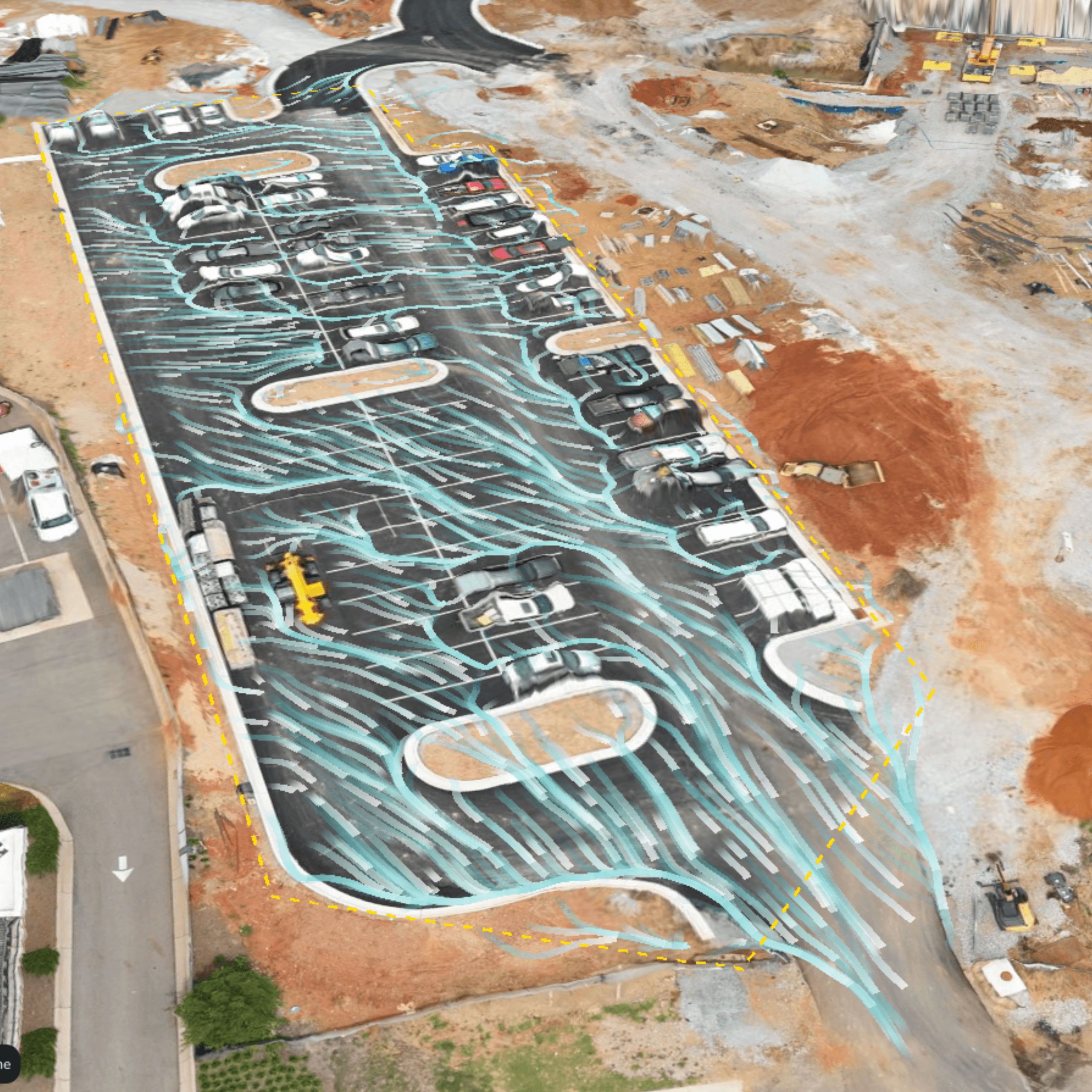
Hydrology analysis
The team uses watershed and surface runoff tools to get ahead of rain events, assessing how water will move across the site and making sure BMPs (best management practices) are positioned correctly before a storm rolls in.
Progress sharing
Owners and clients get direct access to site data, so they can check progress without driving out to the worksite. At project closeout, Burns Dirt has even exported timelapses for clients to use in groundbreaking ceremonies, proving that a small touch goes a long way.
Streamlining earthwork from initial bid to final billing
Four years in, Burns Dirt has streamlined every stage of work with Propeller, from bid creation to final billing. Their ROI shows up in tighter bids, change orders that get paid without a fight, presentations that close deals, and a team where everyone knows how to pull up a survey and read what it’s telling them. “Everybody loves Propeller,” Sullivan told us.
Burns Dirt is now building toward a model where every new hire gets their drone license, so anyone on the team can fly a site and inform the next stage of work with accurate data.
Want to know how Propeller can help you?
Learn more about Propeller’s products, pricing, and how to get started on your site.
You might also like

Cross Section Survey in a Matter of Minutes Using Drone Data

How to Use Drone Data to Improve Landfill Performance
