3 ways PMs stay ahead on earthwork sites

Read Time: 3 mins
Quick links

    Covers three practical ways construction project managers use design comparison tools and high-precision drone surveys to run earthwork projects more effectively. Topics include pre-bid quantity measurement using design-to-design comparison, frequent surface-to-design checks to catch grade errors before they become rework, and cloud-based access to a shared site record that reduces miscommunication and speeds up dispute resolution. Grounded in Propeller’s PPK workflow and real customer outcomes.
    On earthwork projects, the cost of a wrong call compounds fast. A grade error caught on a site map is a quick fix. The same error found at final inspection is a change order, a rework crew, and a schedule conversation nobody wants to have.

    Design comparison tools and high-precision drone surveys give construction PMs a way to stay ahead of that. Here are three ways teams are putting them to work.

    #1: Build a bid you can actually defend

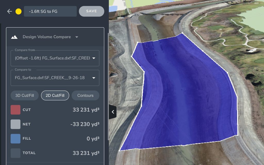
    Design-to-design comparison lets estimators measure the volume of material required between design grades before work starts. Bid quantities come from actual site data, not assumptions baked into a topographic estimate that may be months out of date.

    Starting with accurate pre-bid measurements also gives you a risk management baseline from day one. When you know what the existing grade looks like relative to the design, you can flag potential challenges early, before they show up as mid-project surprises that affect schedule and margin.

    Pro tip: Measure the volume of material required between design grades before your bid goes in. That number is the foundation your whole project cost sits on.

    #2: Catch grade errors before they turn into rework

    Rework is one of the most expensive problems on any earthwork site, and most of it is preventable. The root cause is almost always the same: teams working from data that does not reflect what is actually on the ground.

    High-precision drone surveys give PMs a current surface they can compare directly against design intent. When you can see exactly where the site matches the plan and where it does not, corrections happen while the machine is still on site, not weeks later when the discrepancy shows up in a progress report.

    Propeller’s PPK workflow delivers accuracy to 1/10ft site-wide, giving PMs the precision needed for surface-to-design comparisons that hold up for pay app backup, quantity verification, and change order conversations. Teams running weekly flights with this workflow have reported returns well above what the drone program costs to run — Grade Tech saw 10x ROI after putting it into regular use.

    collaboration on a construction site using drone technology

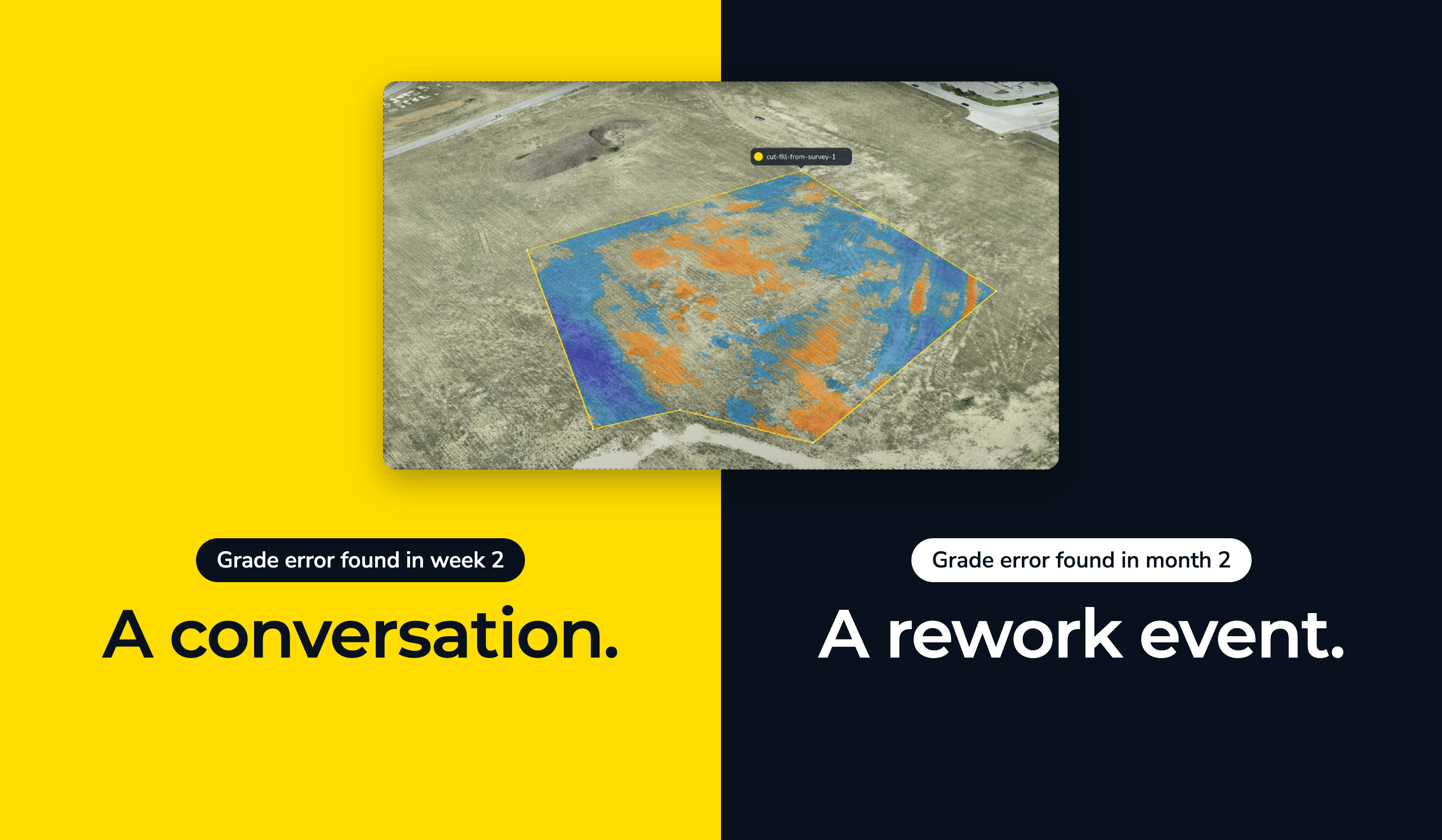
    Pro tip: Run surface-to-design comparisons at regular intervals, not just at handoffs. Catching a grade error two weeks in is a conversation. Catching it two months in is a rework event.

    #3: Give every team the same site record

    Most communication breakdowns on construction sites come down to teams working from different versions of site information. One crew is referencing last week’s survey. Another is working off a design that has since changed. Someone else is going off memory.

    Cloud-based access to a shared 3D map closes that gap. When the foreman, PM, and owner are all looking at the same current site record, you stop debating whose numbers are right and start working from the same truth. Teams that have made the switch report significant time savings across the board — Integrated Sustainability cut time spent on worksite management by 80% after moving to cloud-based data access across their teams.

    A shared site record also makes dispute resolution faster. When a quantity gets questioned or a design change needs backing, the timestamped site data is already there. You are not reconstructing proof after the fact, and you are not asking someone to take your word for it.

    Pro tip: Make sure everyone who needs site data can get to it directly. If the only path to a current site record runs through one person, that is a bottleneck waiting to happen.

    Quick links

      Related articles

      Key Factors to Consider when Building Your 2022 Earthworks Budget

      As we approach the end of the year, 2022 budget planning for construction and earthworks…

      The top 5 time-wasters that are cutting into your profit

      Learn what a point cloud actually is and then how drone data is integrated with…

      Miner and Contractor: Building Stronger Relationships with Propeller

      Miner-contractor relationships are built on communication, trust, and a common understanding of how and when…

      Ready to learn how Propeller can power up your worksite?

      We’re happy to show you how Propeller can power your worksite, and boost productivity.

      Related articles

      AeroPoints Help NOAR Technologies Bring Accurate Ground Control to AEC

      NOAR Technologies is an AEC (architectural, engineering, and construction) tech solutions provider from Detroit, Michigan.…

      A Surveyor’s Guide to Drones: Selecting the Drone, Camera, and Licenses (Part 1)

      Part One—Hardware Since the invention of the total station in the early ’70s and the…

      A Surveyor’s Guide to Drones: How to Get the Job Done Faster Without Compromising on Accuracy

      Part Two—Software Following on from our previous article, which covered selecting the right hardware for…